Scientists have identified deadly brine pools on the bottom of the Red Sea, anoxic environments of extreme salinity that are traps for wildlife but valuable natural laboratories. Their detailed study is possible thanks to geomatics and 3D capture technologies, which allow mapping and modeling these hostile formations with unprecedented precision and without risks to researchers.
3D Technologies to Explore the Extreme Seafloor 🌊
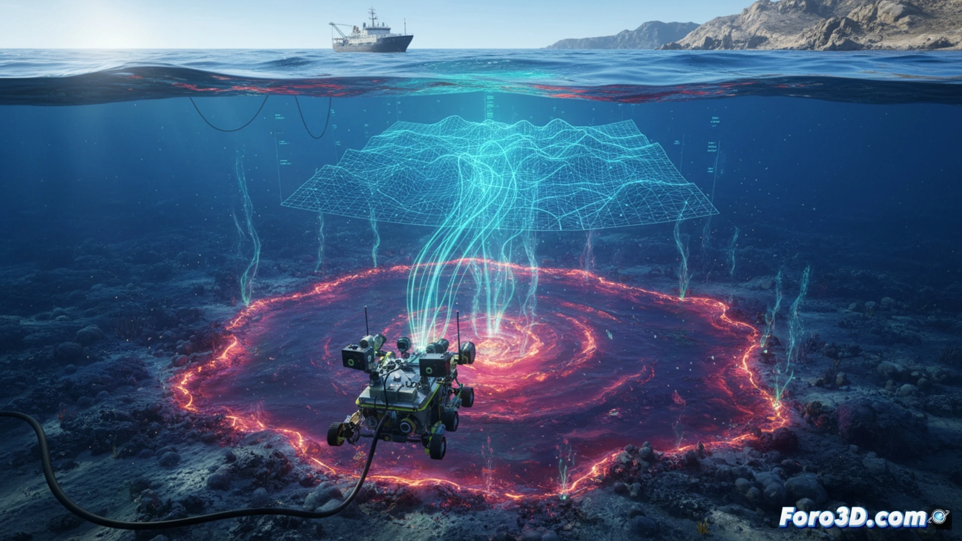
The discovery and analysis of these pools rely on tools like multibeam sonar, which generates high-resolution bathymetric maps delineating their edges and depth. Underwater photogrammetry, via ROVs, captures images to create textured models of their surfaces. This data is integrated into digital twins of the seafloor, allowing oceanographers and biologists to measure volumes, analyze morphology, and simulate the interaction of brine with surrounding water in a faithful virtual environment.
Digital Twins to Unravel Extremophile Secrets 🦠
The resulting 3D models are more than simple maps; they are digital replicas that serve as a permanent basis for research. They enable the study of the temporal evolution of the pools, correlation of their geography with unique microbial communities, and planning of precise sampling. This geomatics approach transforms an inaccessible and lethal environment into an accessible field of study, advancing our understanding of the limits of life on Earth.
How can 3D topography and laser bathymetry techniques be integrated to accurately map the morphology and geological risks of the anoxic brine pools in the Red Sea?
(P.S.: 3D topography is like making a treasure map, but the treasure is a precise model.)