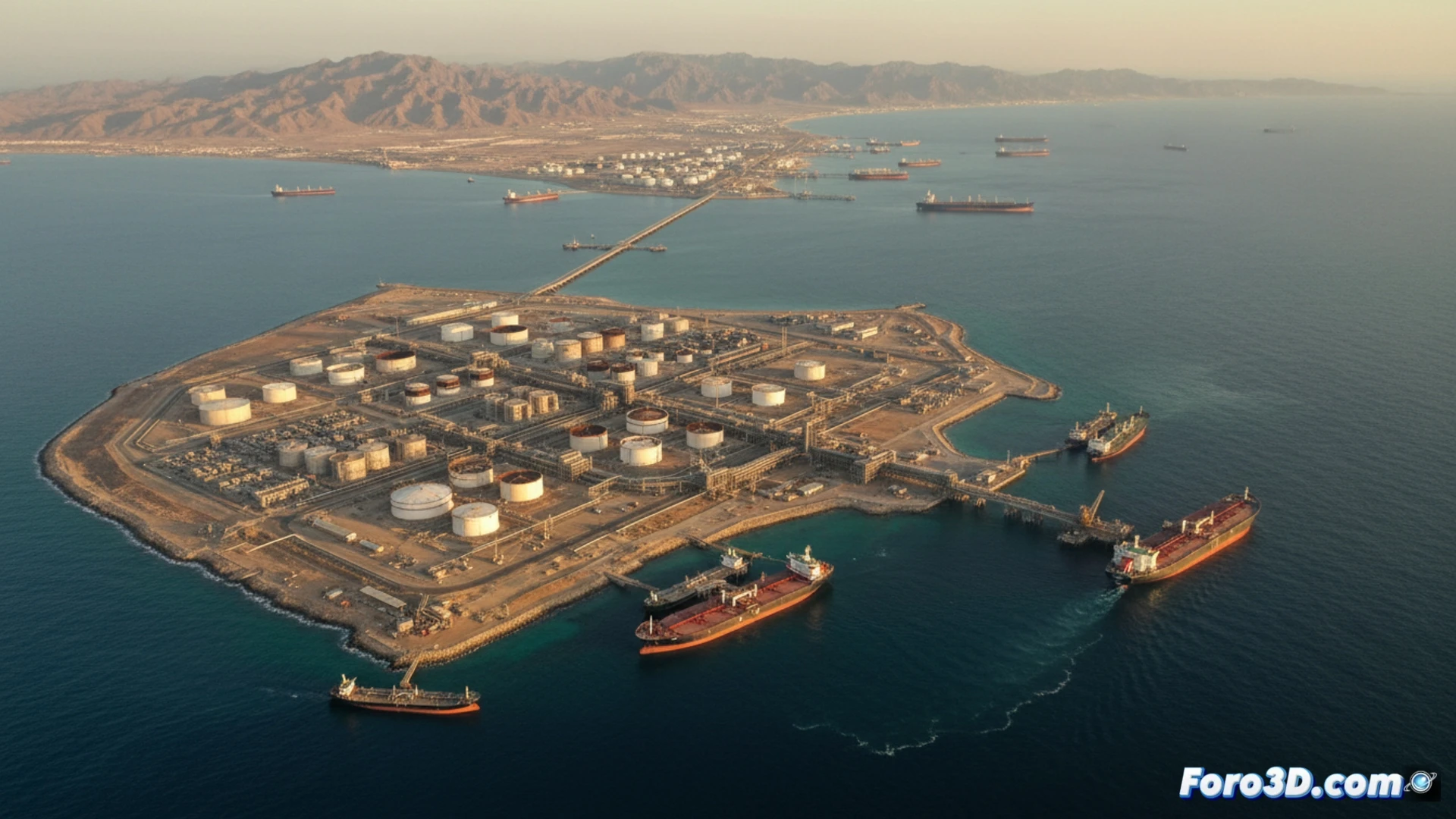
In the heart of the Persian Gulf, Kharg Island operates as the heartbeat of the Iranian economy. This small territory houses the country's most important crude oil export terminal, managing the vast majority of its foreign sales. Its relevance transcends the economic to become a geopolitical weapon. After being the target of attacks, Tehran has threatened reprisals against rival energy infrastructure, evidencing that Kharg is a single point of failure whose vulnerability challenges the stability of the global market.
3D Visualization: Infrastructure and Connection to Critical Routes 🗺️
A 3D model of the island allows for breaking down its strategic configuration. The deep-water docks, vast storage facilities, and pipelines connecting it to the coast can be detailed. The key visualization is its integration into the global maritime map: from Kharg, virtual lines trace the crude oil routes to the Strait of Hormuz, the Indian Ocean, and beyond. The simulation of a disruption scenario, such as a blockade or attack, graphically shows how those flows collapse. The model quantifies the immediate impact: a sharp reduction in world supply, price spikes, and chaotic diversion of tanker traffic.
3D Lesson: The Fragility of Vital Nodes ⚠️
The lesson that Kharg teaches through visualization is clear. The efficiency of the global energy supply chain depends on a few hyperconcentrated nodes. Their strength is also their greatest weakness. A 3D model not only shows geography and infrastructure but reveals the anatomy of systemic risk. By simulating the collapse of a single point, we understand that global energy security is a chain whose weakest link defines its strength. Kharg is the perfect prototype of this interdependent vulnerability.
How does the strategic vulnerability of the Kharg oil terminal influence the resilience and reconfiguration of global energy supply chains?
(P.S.: geopolitical risk maps are like the weather: there's always a storm somewhere)