A scientific project using Japanese technology has mapped in three dimensions the seafloor near Istanbul. The objective is to analyze in detail the geological faults in this area of high tectonic activity. The data obtained will allow refining risk models and improving prevention systems. The researchers indicate that it is routine study work and not a cause for immediate alarm.
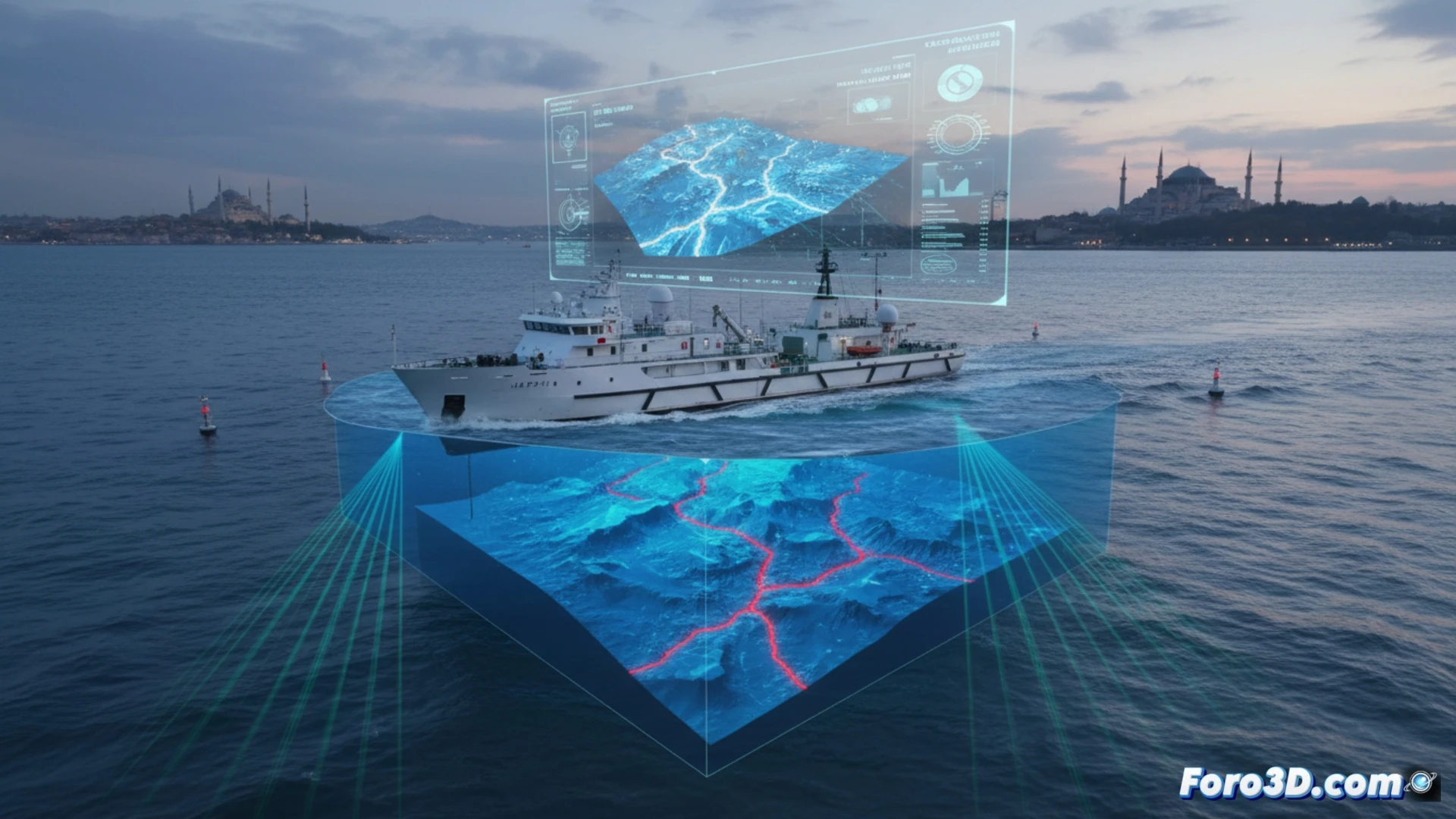
Multibeam sonar technology and 3D modeling to reveal hidden faults 🔍
The technique used is based on high-resolution multibeam sonars mounted on vessels. These devices emit a fan of acoustic beams that bounce off the seafloor, precisely measuring its depth and topography. The data is processed to generate three-dimensional models that reveal fractures, folds, and other geological structures. This level of detail helps identify active faults and assess their potential to generate seismic movements.
The Earth has no privacy: even its most intimate cracks are being scanned 😳
It seems no corner of the planet is safe from a scanner. First it was street maps, then aerial views of our backyards, and now even the hidden cracks under the sea are being exposed in 3D. It's as if the Earth's crust were in a permanent geological check-up, where geologists are the doctors who ask show me where it hurts. At least, with these check-ups, they might warn us before it decides to stretch abruptly.