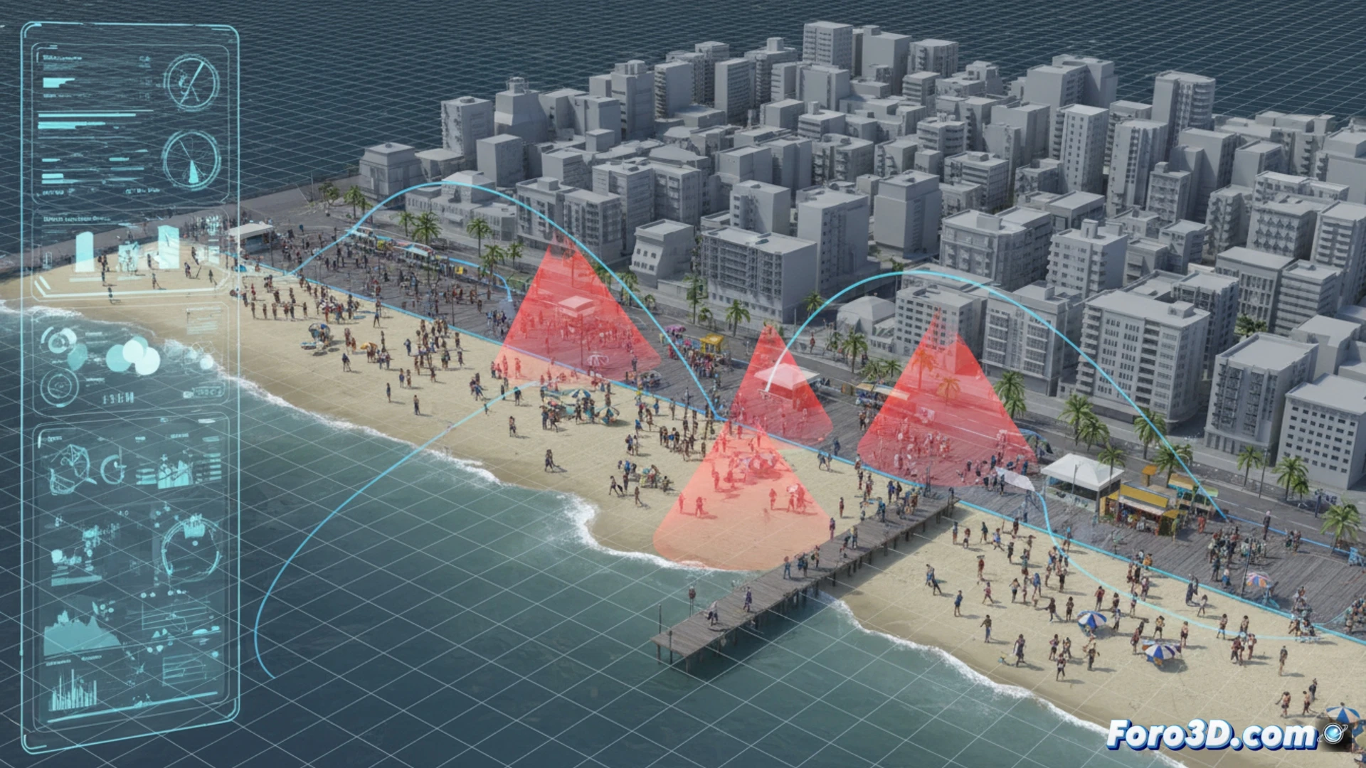
News about beach robberies, scams with fake help, or bracelet frauds describe patterns but lack spatial context. How do environments get exploited? Scene analysis through 3D documentation transforms these descriptions into investigable models. Digitally recreating the location of a sun lounger, an ATM, or a congested pedestrian crossing allows dissecting the crime, studying distances, lines of sight, and blind spots that criminals exploit.
Photogrammetry and Laser Scanning for Forensic Reconstruction 🕵️
Techniques such as photogrammetry, from photographs, or mobile laser scanning allow capturing the scene of a recurrent crime with precision. A georeferenced 3D model of a beach shows the paths between the shore and the umbrellas, revealing approach and escape routes. For a scam at an ATM, the victim's field of view can be simulated, identifying obstacles that isolate. These models are objective bases for analyzing patterns, testing hypotheses about modus operandi, and generating spatial data for prevention.
From Reconstruction to Proactive Awareness 🧠
The final value transcends investigation. These 3D models are powerful pedagogical tools. Immersive virtual tours can be created to train agents, showing critical points in real time. To raise public awareness, animations derived from the model can illustrate, in a clear and graphic way, how a fake signature scam unfolds in a specific square, transforming a generic warning into a striking and memorable visual lesson based on real scenarios.
What minimum resolution would you need for this analysis?