An earthquake with an estimated magnitude between 4.1 and 4.6 has shaken the Catania and Etna region, generating alarm and activating evaluation protocols. Although no injuries have been reported, the event underscores the constant seismic threat in the area. In this context, 3D modeling technologies emerge as fundamental allies for post-event management, enabling precise documentation and in-depth analysis that goes beyond traditional visual inspection.
Documentation and Analysis with Drones and 3D Scanners 🚁
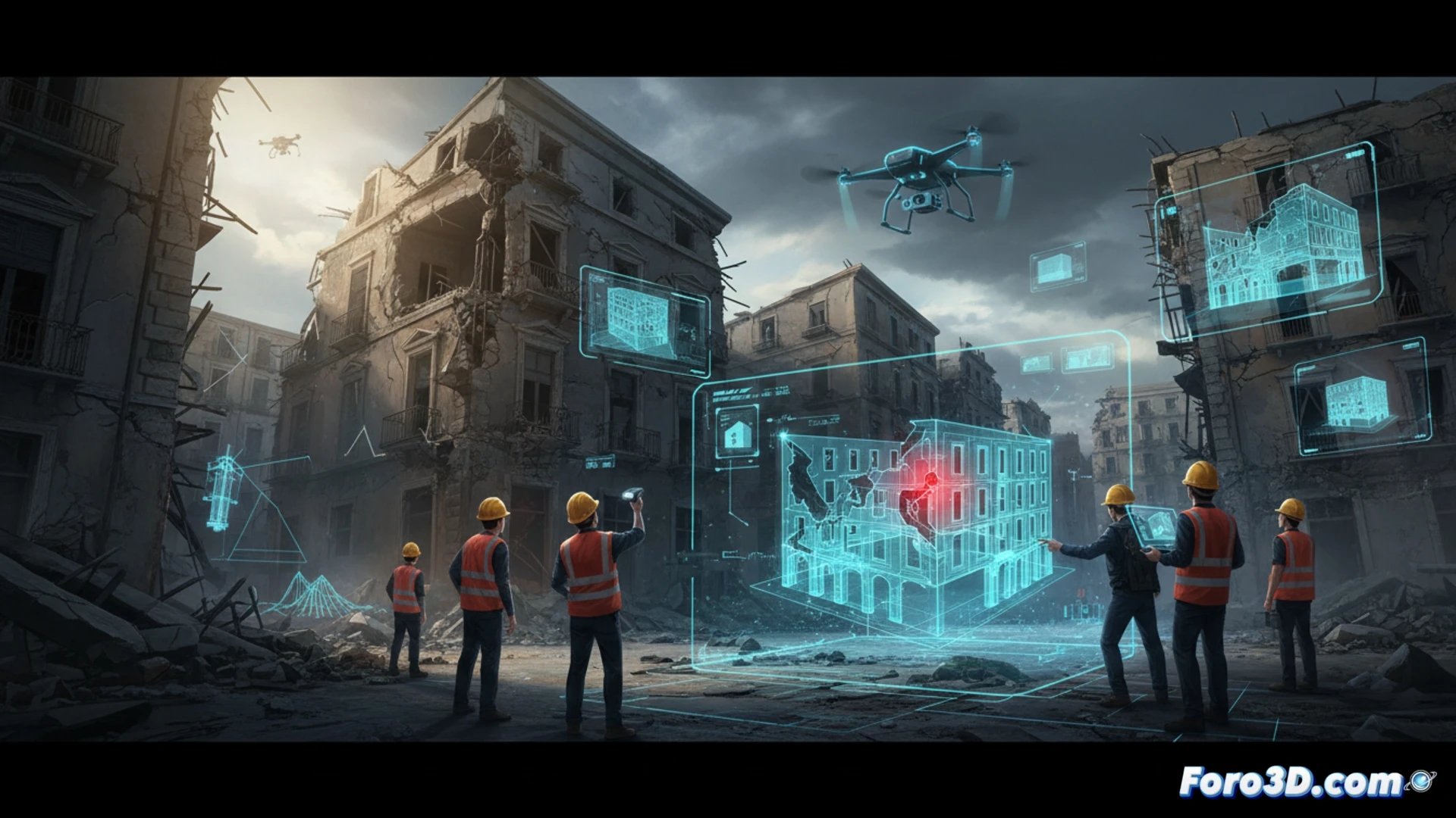
After an event like this, the priority is to assess damage to infrastructure quickly and safely. Here, photogrammetry with drones and LiDAR scanning are revolutionary. These systems can generate point clouds and photorealistic 3D models of affected buildings, cracks in facades, or collapses. These digital models allow engineers to measure fractures with millimeter precision, identify hidden structural damage, and virtually simulate collapse or stability scenarios in the face of possible aftershocks, optimizing decisions on evacuation or reinforcement.
Towards Digital Twins for Prevention 🧠
The true potential lies in creating digital twins of entire cities. By integrating INGV data, geological models, and 3D scanning of the built heritage, predictive simulations can be developed on how buildings would respond to different seismic intensities. For regions like the Etna area, this means moving from a reactive response to proactive planning, visualizing risks and designing more robust and understandable emergency plans for authorities and citizens.
Would you simulate the event with Houdini or with a game engine?