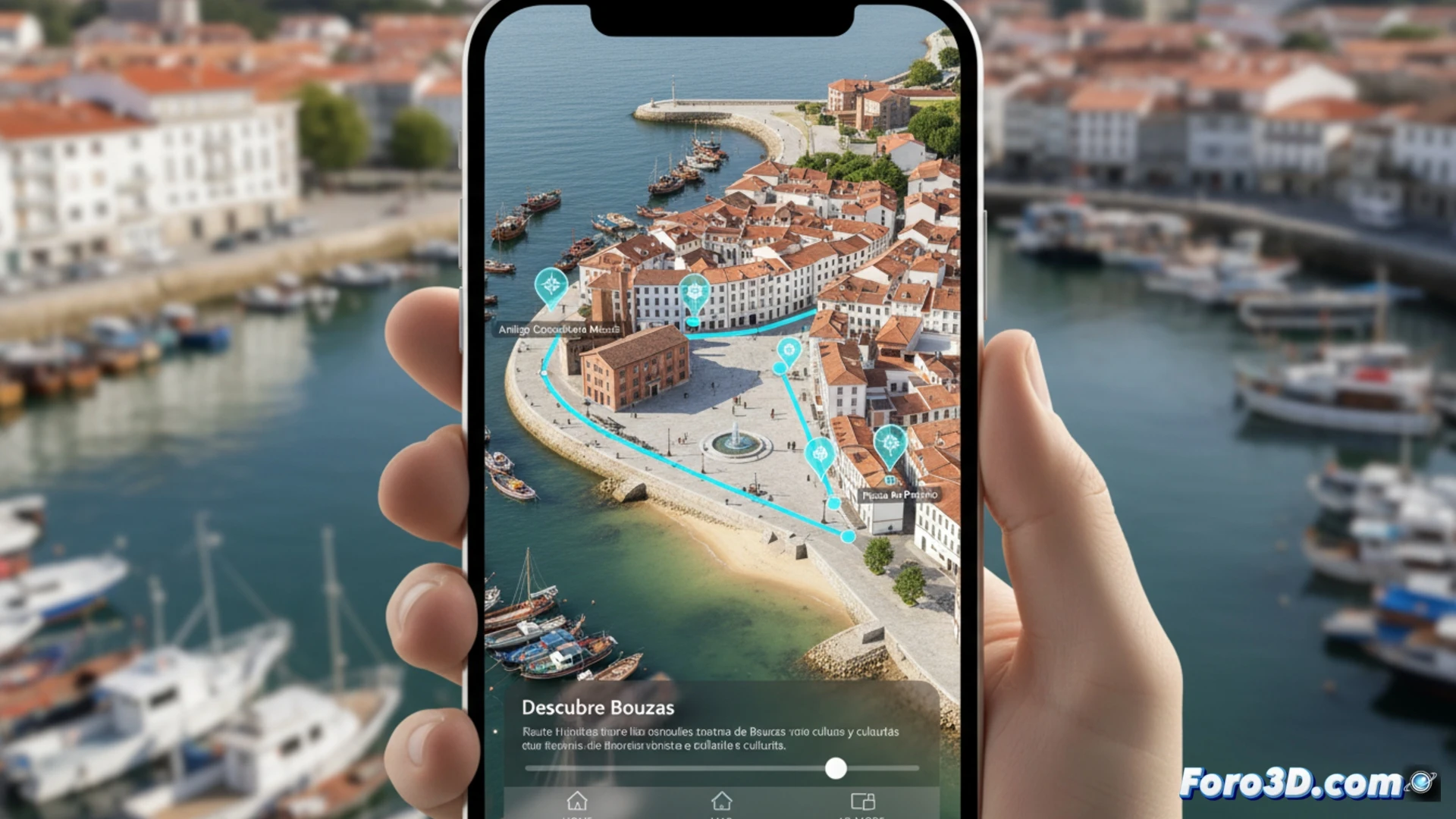
The fishing neighborhood of Bouzas, in Vigo, is preparing for a time travel journey through technology. A neighborhood initiative, developed by a specialized company, will create a 3D recreation accessible from a mobile app. This will include a route with 16 points of interest, such as the old cannery Massó, fusing heritage and outreach. The project exemplifies how digital archaeology not only documents remote sites but also activates living urban heritage, offering a powerful tourist and educational tool.
From historical plan to app: workflow in digital archaeology 📱
The process follows the methodology typical of digital archaeology. First, the historical documentation phase, already underway, compiles plans, old photographs, and data on the 16 landmarks. Then, for capturing the current reality, terrestrial photogrammetry or LiDAR scanner is likely used, obtaining a precise point cloud of facades and spaces. With that data, 3D assets are modeled, prioritizing historical accuracy in disappeared or transformed elements. Finally, they are integrated into an interactive application that overlays layers of information, allowing the user to explore temporal comparisons and access detailed content, closing the cycle of digital preservation and outreach.
More than a tourist route: conservation and democratization of heritage 🏛️
This project transcends technological novelty. The 3D recreation acts as a digital record for preventive conservation, an invaluable backup against possible deteriorations. Additionally, it democratizes access to heritage, bringing local history to anyone with a mobile phone, either on-site or remotely. Thus, digital archaeology reveals itself as a key discipline for valuing the collective memory of neighborhoods, transforming public space into an open and accessible museum 24 hours a day.
How can the 3D reconstruction of a historic neighborhood boost citizen participation and transform urban heritage management?
(P.S.: and remember: if you can't find a bone, you can always model it yourself)