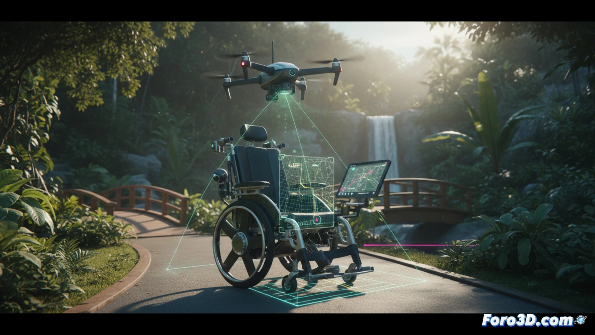
Reduced mobility finds a revolutionary ally in the convergence of 3D sensors and artificial intelligence. A team of researchers is developing a prototype of a smart wheelchair that navigates autonomously. Its secret is a system that fuses the wheelchair's local perception with aerial mapping from a drone, creating a real-time digital twin of the environment to plan safe and accessible routes, granting unprecedented autonomy. 🤖
Sensor fusion and digital twin: the technology behind active protection 🛡️
The system is based on an architecture of active protection through data fusion. The wheelchair, equipped with laser scanners and a depth camera, detects immediate obstacles. Simultaneously, a drone explores and maps the environment from above, identifying ramps, uneven surfaces, and optimal routes. Both data streams are integrated to generate a dynamic and precise 3D model, a digital twin that allows the navigation AI to make contextual decisions, avoiding dead ends or unsafe surfaces, and not just dodging obstacles.
More than technology: autonomy as a fundamental right ⚖️
This advancement transcends the technical to position itself as a human rights tool. By prioritizing accessibility in route planning and reducing dependence on constant assistance, the technology returns control to the user. It represents a conceptual leap: from the wheelchair as a mere instrument to a system of protection and empowerment that materializes the right to personal mobility and full social participation.
How to ensure physical safety and data privacy in an autonomous wheelchair assisted by drone and AI for complex urban environments?
(P.S.: verifying status is like leveling the bed: if you don't do it right, the first layer (and the rights) fail)