The recent exchange of attacks between Israel and Iran, with missiles and drones against civilian targets, generates an urgent need for objective documentation. 3D technologies offer crucial tools for this purpose. Through photogrammetry with satellite and drone images, it is possible to digitally reconstruct the affected areas, quantify damage to infrastructure, and create an invaluable forensic record. This technical analysis transcends the political narrative, providing tangible evidence to assess the real impact and possible violations of International Humanitarian Law.
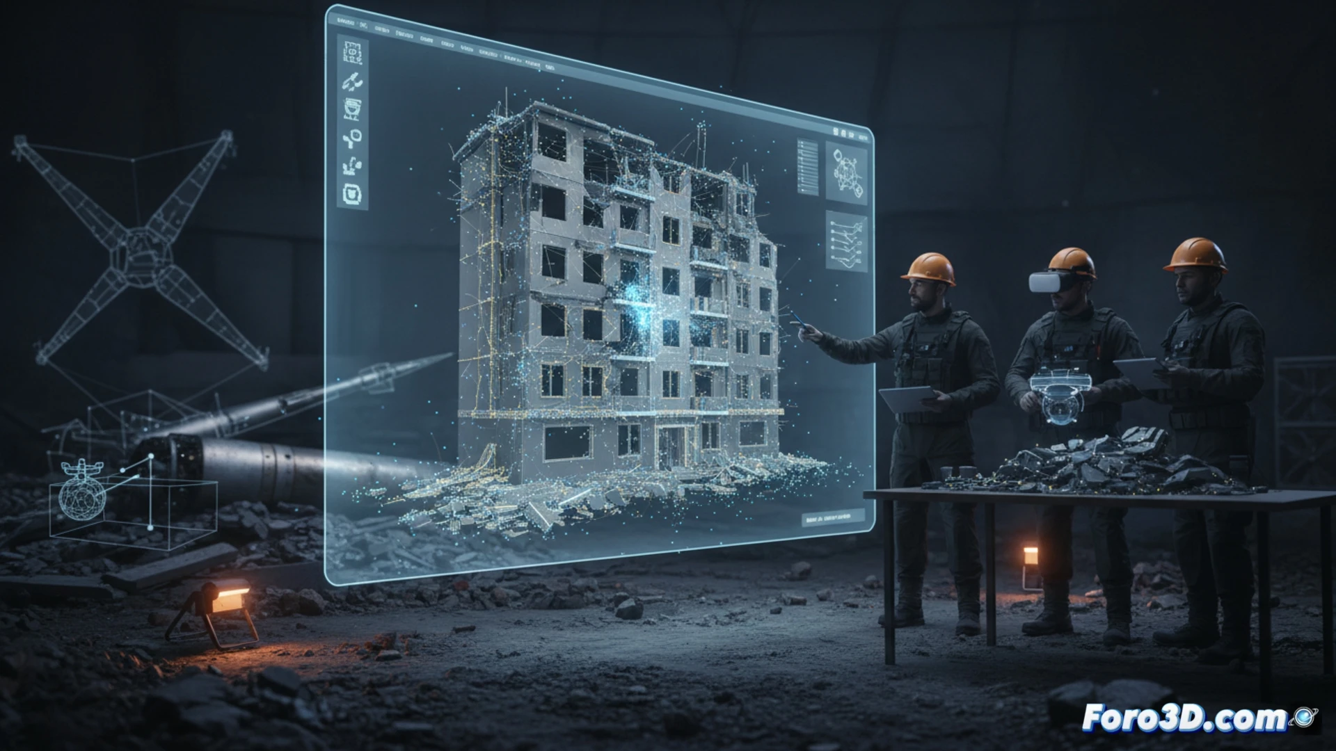
Forensic reconstruction and geospatial visualization of the impact 🗺️
An interactive 3D model of a bombed area would be the centerpiece of this analysis. Multiple layers of data would be integrated: a high-precision textured model showing the damaged buildings, obtained through LiDAR or photogrammetry. Over this, a geospatial layer would visualize the hypothetical trajectories of the projectiles and impact points, cross-referencing this data with the location of protected civilian infrastructure. This reconstruction would allow analysis of attack patterns, calculation of impact angles, and precise delimitation of the destruction radius, providing forensic clarity to the debate on proportionality and distinction between military and civilian targets.
3D evidence as a tool for accountability ⚖️
Beyond mere visualization, these 3D models become robust technical evidence. They can be used by international organizations, researchers, and journalists to verify statements, contextualize the scale of the damage, and raise public awareness about the human cost of modern conflicts. In a scenario of cross-accusations, as exposed between Israel and Iran, impartial digital documentation stands as an essential counterbalance, promoting transparency and laying the foundations for future accountability under the international legal framework.
How would you reconstruct in 3D a historic building destroyed to document the damage?