Following the rocket attack in Tel Aviv, the media initially reported the destruction of an empty residential building. However, details such as clothes hanging out to dry and the subsequent official correction, which confirmed one fatality and dozens of injuries, evidence the initial disinformation. This case underscores the urgent need for objective tools to assess damage in conflicts, beyond immediate media narratives.
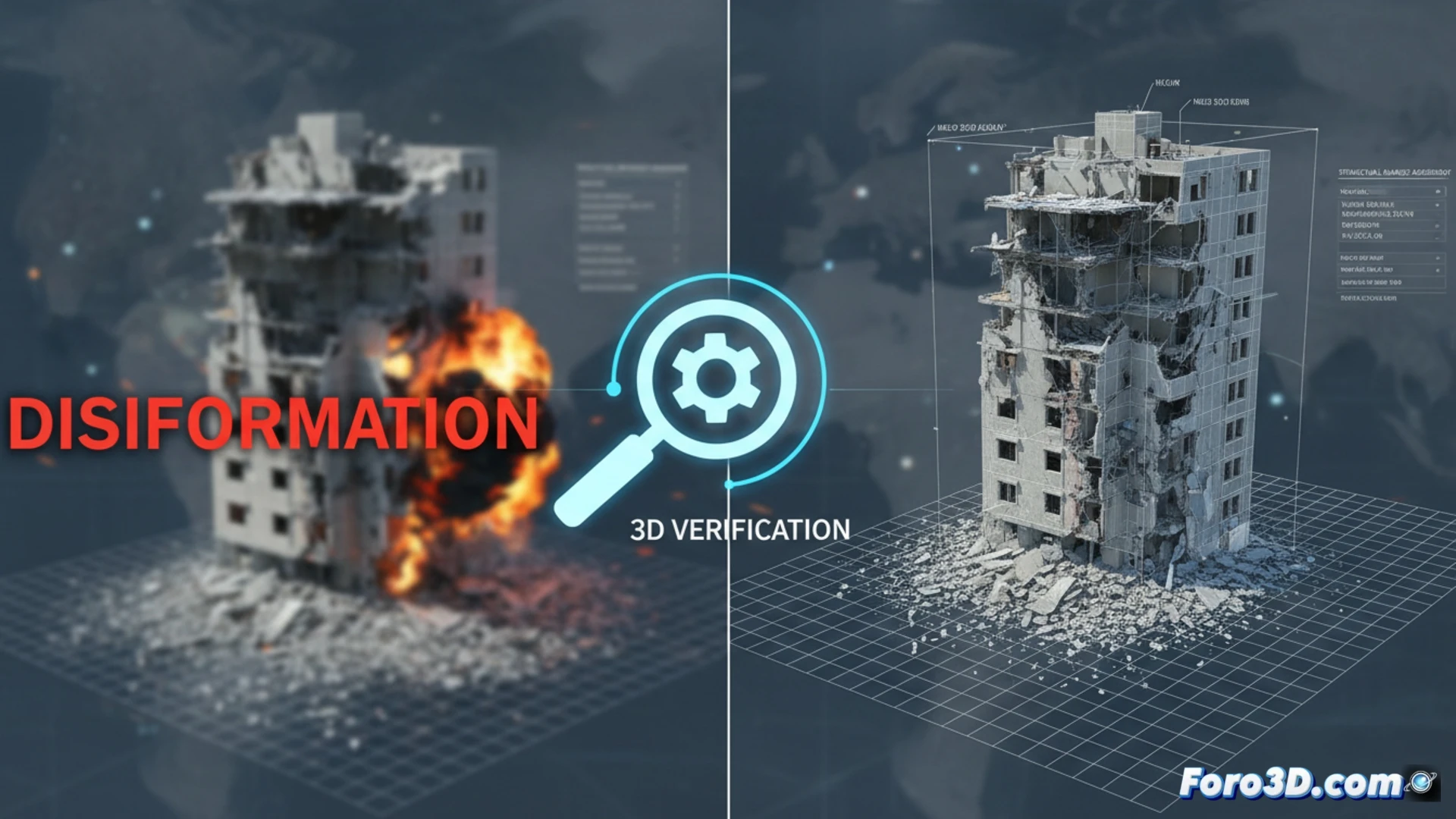
Photogrammetry and LiDAR: forensic verification in near real-time 🔍
Aerial photogrammetry with drones and terrestrial LiDAR scanning could have documented the scene minutes after the impact. By processing these captures, a high-precision geo-referenced 3D model is generated. This digital twin enables forensic analysis: calculating debris volumes, identifying collapsed structures, and comparing the state with previous satellite images. Thus, the real extent of damage to the adjacent historic building and the residential block is verified, objectifying the assessment and documenting the lost heritage with unquestionable technical rigor.
Beyond the ruins: preserving memory and demanding truth 💾
3D technology transcends mere visual reconstruction. It becomes an instrument to preserve architectural memory in an immutable way and a verification standard that demands greater informational rigor. In a context of disinformation, these models act as neutral technical evidence, essential for countering erroneous or biased narratives and for remembering, with concrete data, the human and cultural cost of conflicts.
How can 3D analysis with specialized software accurately verify and quantify real structural damage in buildings after an attack, contrasting official information with visual evidence?
(P.S.: virtually reconstructing is the first step to reconstructing in reality) 🏗️