The recent US bombing of Iranian facilities near the strategic Strait of Hormuz transcends political news. From our niche, we address it as a case study for spatial and structural analysis. Using 3D technologies, we can break down the event: reconstruct the target base, simulate the effects of heavy munitions, and geo-reference the scenario. This approach turns a headline into a tool for deep technical understanding of tactics, potential damage, and geostrategic value.
Reconstruction and Simulation: From Terrain to Estimated Structural Damage 🎯
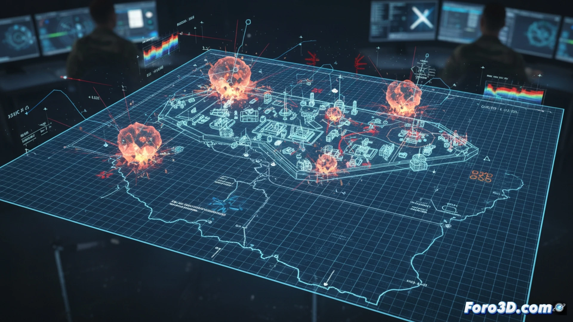
The first step is a geo-referenced 3D model of the Strait of Hormuz, integrating bathymetry, orography, and the exact location of the facilities. Over satellite images, the architecture of the targets is reconstructed. Then, using simulation software, the type of heavy munitions reported is introduced. Physics calculates the propagation of the shockwave, penetration, and progressive structural collapse. The result is not a simple animation, but a technical visualization that estimates the extent of damage, affected critical zones, and probable disablement of infrastructures, offering a tangible assessment.
3D Visualization as a Strategic Analysis Tool 🗺️
This modeling exercise demonstrates the power of 3D visualization for military analysis. An interactive map of the strait reveals why that point is a priority target: control of maritime traffic. Damage simulation quantifies the immediate tactical impact. Beyond speculation, this methodology offers an objective framework to understand the capabilities and limitations of an attack, transforming scattered data into a coherent and technical spatial narrative, essential for analysts and strategy enthusiasts.
Do you think digital twins can help in post-conflict reconstruction?