Snatch-and-grab robberies in public spaces are quick and traumatic crimes that leave little physical evidence. Traditional documentation is often insufficient to capture the environmental complexity of the location. This is where 3D technology scene analysis makes the difference. Photogrammetry and laser scanning allow for the creation of an exact and permanent digital model of the environment, an invaluable resource for investigators and urban planners seeking not only to solve cases but also to prevent future incidents.
Photogrammetry and LIDAR: capturing the crime scene in three dimensions 🕵️
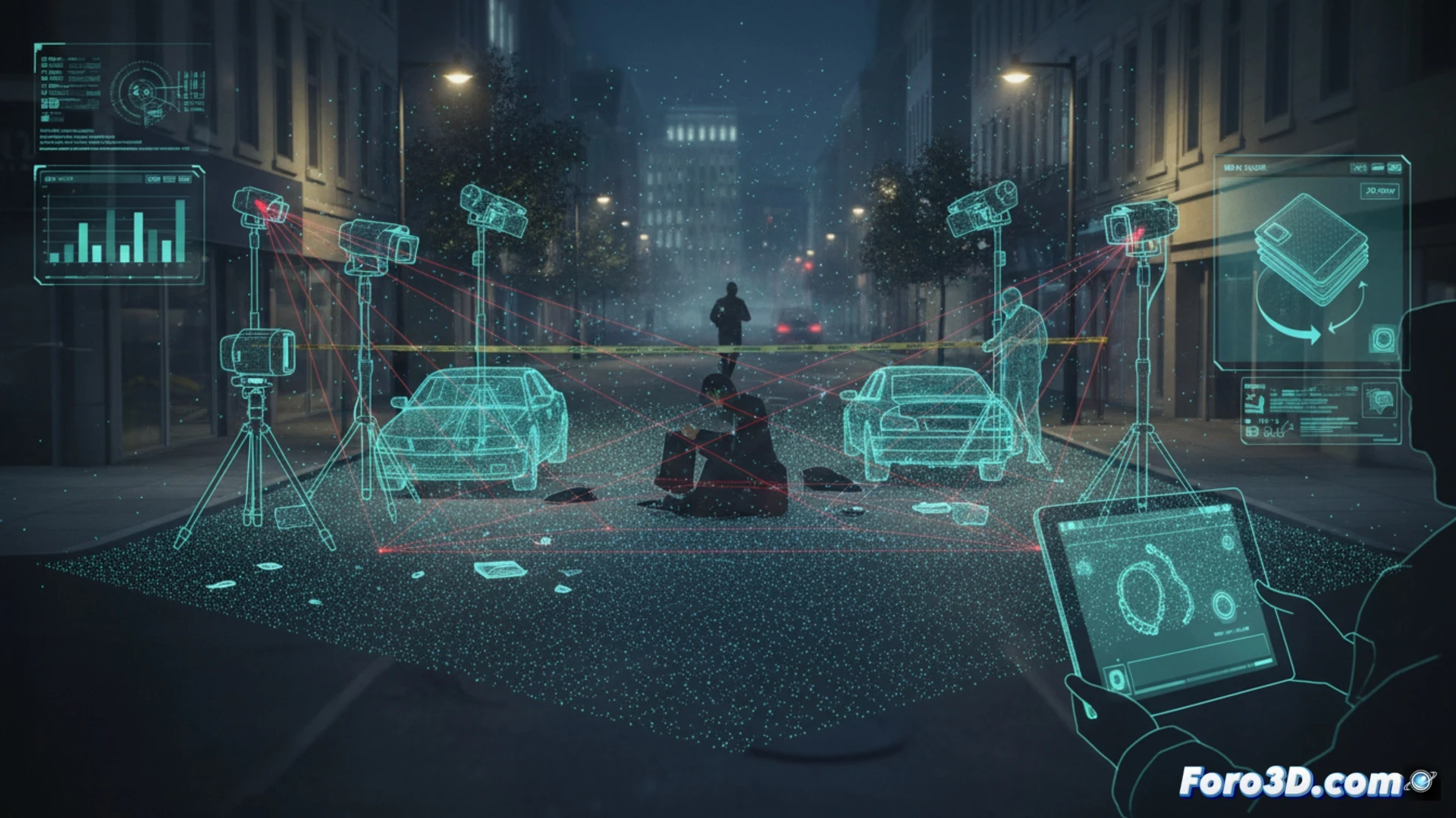
After a snatch-and-grab, data collection is crucial. Through photogrammetry, multiple photographs of the location are processed to generate a textured and precise 3D model. Complementarily, a laser scanner (LIDAR) captures millions of measurement points, creating a point cloud that defines the geometry with millimeter accuracy. This digital reconstruction allows for the analysis of key factors: visual blind spots from where the criminal lurks, potential escape routes, lighting levels at the time of the incident, and the arrangement of urban furniture. Perspectives and trajectories can be simulated, identifying specific patterns and vulnerabilities of the location.
From investigation to prevention: data-informed urban design 🏙️
The value of these 3D models goes beyond individual police investigations. By accumulating and studying reconstructions of multiple similar incidents, recurrent criminal patterns in urban design can be identified. This empirical information is powerful for guiding proactive security interventions: relocation of lighting fixtures, pruning of vegetation that creates hiding spots, redistribution of furniture, or changes in pedestrian flows. 3D technology turns the crime scene into objective data to build safer cities.
What minimum resolution would you need for this analysis?