The term cryoferret describes the catastrophic detachment of a mass of ice, whether a glacier, an ice cornice, or a cryogenic deposit. This phenomenon, amplified by climate change, represents a growing risk for infrastructure and populations in high mountain areas. 3D simulation allows modeling the dynamics of the collapse, ice fragmentation, and its trajectory, offering crucial data for risk assessment and territorial planning.
Dynamic modeling and trajectory analysis in simulation software 🧊
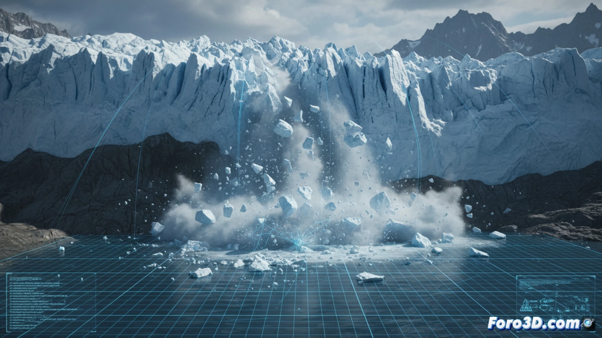
To recreate a cryoferret detachment, LiDAR topographic data and historical meteorological records are used as a starting point. The 3D model discretizes the ice mass into particles or finite volumes, applying parameters of friction, cohesion, and density. The simulation solves equations of fluid dynamics and solid mechanics to predict the speed, impact zone, and debris distribution. Comparative before-and-after visualizations allow identifying escape zones and evaluating the effectiveness of physical barriers or containment dikes.
Prevention and design of resilient infrastructure 🏔️
The predictive capacity of these simulations transforms disaster management. By identifying fracture patterns and avalanche routes, engineers can design settlements and roads with dynamic safety margins. Cryoferret analysis not only saves lives but also redefines mountain architecture, integrating real-time monitoring and 3D models as essential tools in the face of an increasingly extreme climate.
Is it possible to accurately model the dynamic fracture of ice in a cryoferret detachment using 3D simulations based on discrete elements, or is it necessary to also incorporate thermodynamic factors to predict the collapse trajectory.
(PS: Simulating catastrophes is fun until the computer melts down and you are the catastrophe.)