A hospital obstruction, whether from debris, mudslides, or external attacks, paralyzes the healthcare response capacity at the critical moment. 3D modeling and digital twin technology allows recreating these scenarios with millimeter precision, evaluating structural collapse and blockage points to design alternative access routes for ambulances and emergency personnel.
Digital Twins and Evacuation Route Analysis 🏥
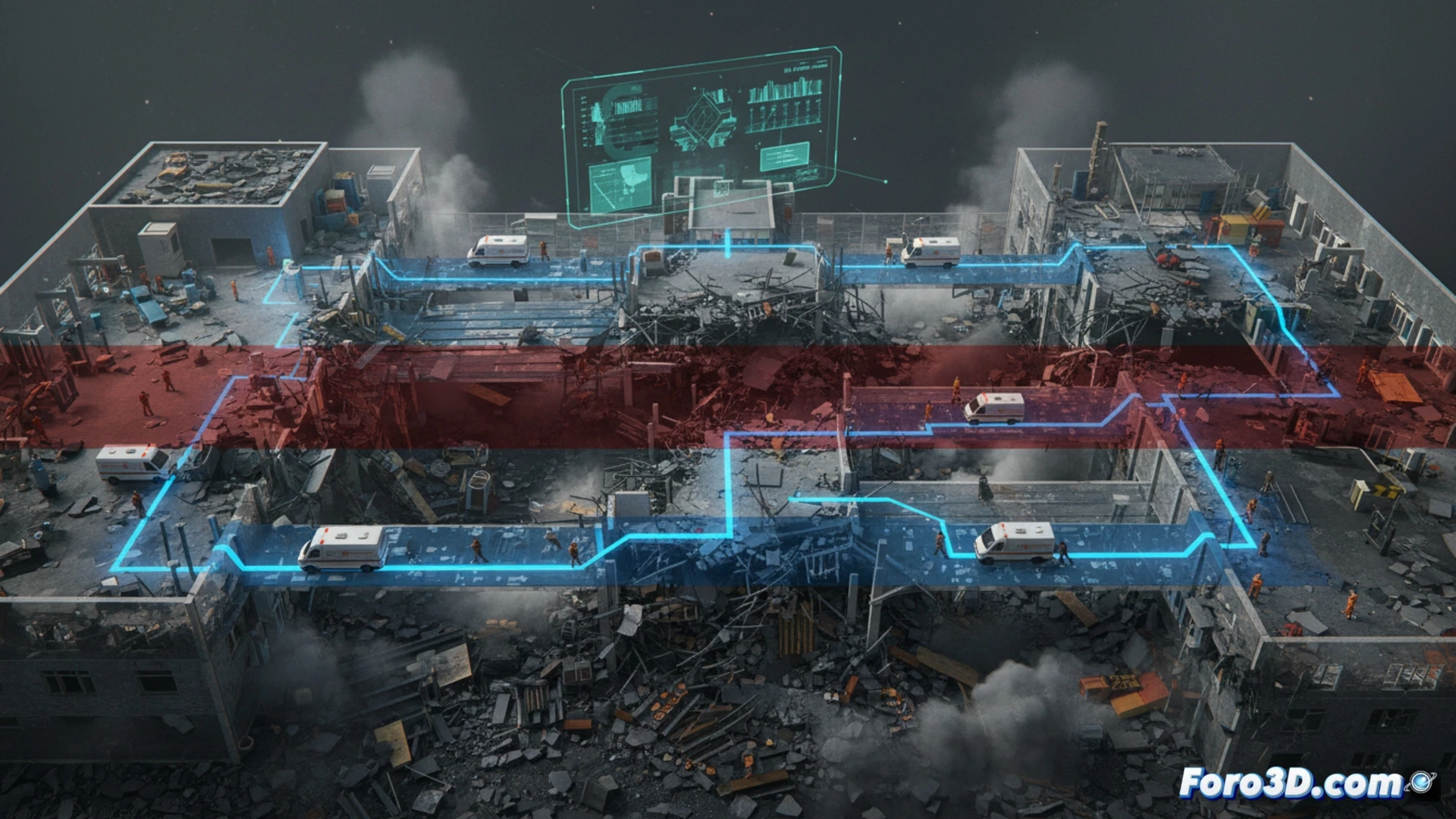
The use of hospital digital twins allows simulating the impact of an obstruction in real time. Through LiDAR scanning and photogrammetry, a 3D model of the healthcare center and its perimeter is generated. This model is integrated with geographic information systems (GIS) to calculate pedestrian and vehicular detours. The simulation evaluates the resistance of walls and doors to impacts, identifying viable secondary access points. The resulting data allows updating emergency plans, optimizing the location of mobile triage units and temporary helipads, reducing response time in the first minutes of the disaster.
The Need to Anticipate the Impossible 🚨
Hospital obstruction does not only physically block a building; it paralyzes the chain of survival. 3D simulation forces us to visualize the worst possible scenario, from an earthquake to a vehicle attack. By modeling these crises in a safe virtual environment, emergency managers can train massive patient diversion protocols and activate alternative supply routes. Technology does not prevent the disaster, but it gives us the map to navigate its debris.
How can 3D simulation of hospital obstructions improve evacuation and casualty relocation protocols in highly complex disaster zones?
(PS: Simulating disasters is fun until the computer crashes and you are the disaster.)