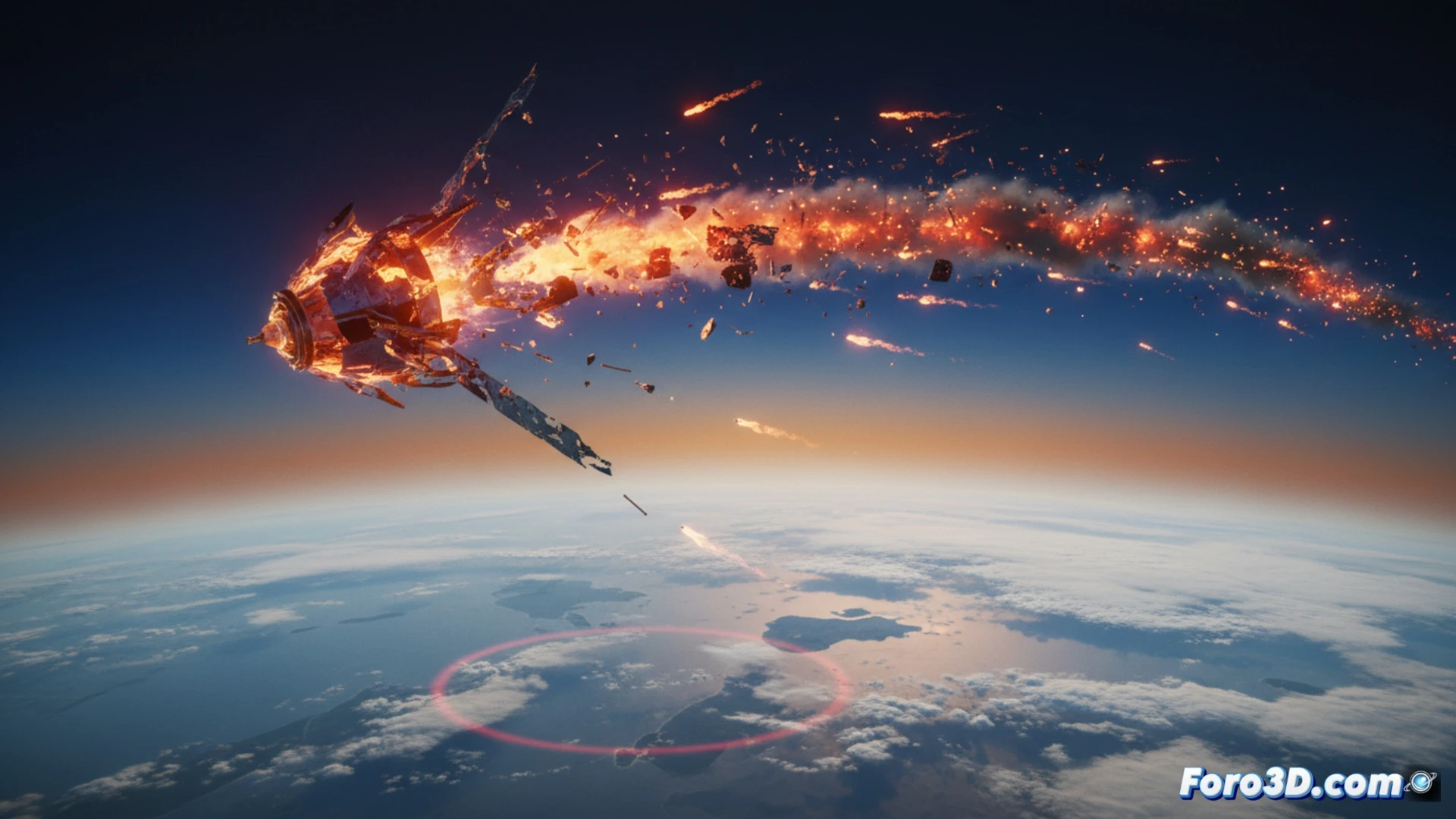
Space debris represents a growing threat to orbital and terrestrial infrastructure. When a piece of debris loses its orbit, its atmospheric reentry can be catastrophic if it does not completely disintegrate. This article explores how 3D simulation allows modeling the ballistic trajectory, fragmentation due to thermal stress, and the impact zone of these objects, offering a visual tool to understand the risk and plan responses to a possible crash.
Technical Modeling of Disintegration and Impact 🛰️
To simulate this phenomenon in 3D software such as Blender or Houdini, the dynamics of rigid bodies and particle systems must be modeled. First, the reentry trajectory is calculated by applying gravitational and atmospheric drag forces. Then, the fragmentation simulation is activated: the object splits into multiple pieces upon exceeding temperature and pressure thresholds. Each fragment behaves as an independent projectile with its own mass and velocity. Finally, the particle cloud is projected onto a digital terrain model, calculating impact density and areas of highest risk for civil infrastructure, such as power plants or urban zones.
Visualizing Risk to Prevent Disaster 🌍
Beyond technical realism, these simulations serve a crucial educational and preventive function. By rendering crash scenarios, the public and civil protection agencies can be educated about the unpredictability of these events. Visualizing in 3D how a fuel tank or solar panel impacts the ground helps to gauge the threat, promoting mitigation policies such as the active removal of obsolete satellites and the design of components that completely disintegrate during reentry.
How can 3D simulation of orbital debris fragmentation help predict the trajectory of dangerous debris towards populated areas or critical infrastructure on Earth?
(PS: Simulating catastrophes is fun until the computer crashes and you are the catastrophe.)