The collapse of the San Esteban slope represents a critical case study for geotechnical engineering and disaster simulation. This disaster, where the hillside suddenly gave way, exposed the fragility of infrastructure in the face of natural and human phenomena. Through 3D reconstruction, we can analyze the variables that precipitated the collapse, from soil saturation to accumulated vibrations, offering a technical lesson for future prevention.
Geotechnical analysis and simulation of structural failure 🏔️
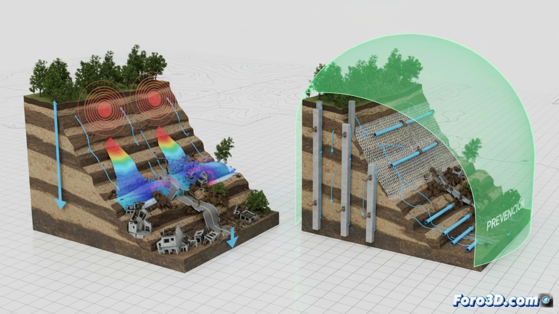
The three-dimensional modeling of the slope before the collapse reveals an unstable geometry, with slopes exceeding 35 degrees at its critical point. Using finite element software, three triggering factors were simulated: torrential rain that raised pore pressure to 60% above the safe threshold; vibrations from heavy machinery at the crest, which generated cyclic fatigue in the rock mass; and progressive material degradation due to water erosion. The visual comparison between the pre- and post-collapse state shows a 45% loss of basal support, which activated a translational rotational failure. The simulation confirms that the combination of these factors exceeded the residual shear strength of the ground.
Digital twins as an active monitoring tool 🛰️
The lesson of San Esteban drives us to adopt digital twins for real-time monitoring of critical slopes. These virtual models, fed by inclinometer, rainfall, and seismograph sensors, can predict the evolution of instability weeks in advance. Implementing this technology not only saves lives but also reduces repair costs by enabling early interventions. The catastrophe reminds us that the ground does not forgive negligence; 3D simulation is today the best defense against gravity.
What role did the hydrogeological conditions prior to the collapse play in the accuracy of the 3D reconstruction models of the San Esteban slope, and how could this data be integrated into future predictive simulations to prevent similar disasters?
(PS: Simulating disasters is fun until the computer crashes and you are the disaster.)