The detection of clandestine graves has evolved from random excavation towards forensic precision. The concept of terrain weighing applies 3D geomatics techniques to measure micro-variations in surface and soil compaction. This article explains how airborne LiDAR and drone photogrammetry allow for the identification of topographic and spectral anomalies, transforming a topographic survey into a criminal investigation tool.
Technical workflow: from survey to anomaly model 🗺️
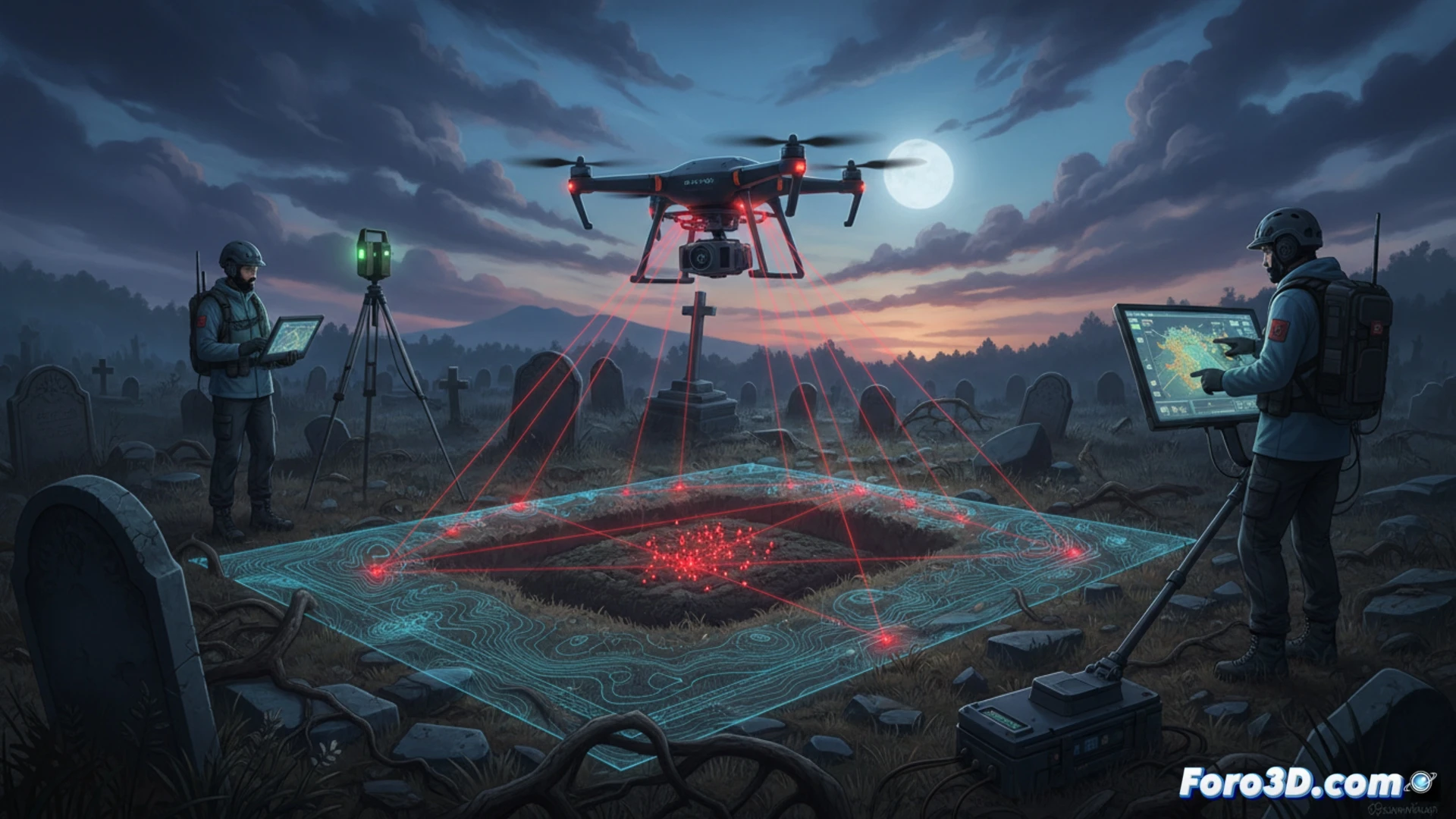
The process begins with a drone flight equipped with a multispectral camera or LiDAR sensor. The resulting point cloud is georeferenced with centimeter accuracy using ground control points. The next step is generating a high-resolution Digital Elevation Model (DEM), filtering out vegetation. Micro-relief analysis algorithms, such as curvature calculation or roughness index, are applied to this DEM. A hidden grave manifests as a subtle depression (due to compaction) or an artificial mound (due to soil swelling). Additionally, the spectral signature of disturbed soil shows differences in the near-infrared, detectable through differential vegetation indices. Integrating this data into a GIS allows for generating anomaly probability maps, guiding forensic excavation with minimal impact on the scene.
The weight of precision in the search for truth ⚖️
Beyond technology, terrain weighing is an act of responsibility. Each cubic centimeter of the digital model represents a methodological decision that can make the difference between finding evidence or destroying it. Forensic geomatics does not just measure the terrain; it measures the distance between data and justice. In a field where error costs lives, the accuracy of the 3D survey becomes the most silent and, at the same time, the most compelling testimony.
Since terrain weighing is based on differences in soil density and compaction, what factors such as moisture variability or the presence of deep roots could alter the accuracy of a LiDAR scan or point cloud when detecting a possible hidden grave?
(PS: 3D topography is like making a treasure map, but the treasure is an accurate model.)