Illegal underground excavation represents a silent catastrophe that can trigger urban collapses, landslides, and massive structural damage. Thanks to 3D technologies such as aerial photogrammetry and terrestrial LiDAR, it is now possible to model the subsurface with centimeter precision, revealing hidden cavities that no human eye could detect. These tools allow prevention teams to anticipate disaster.
Photogrammetry, LiDAR, and digital twins for cavity detection 🕳️
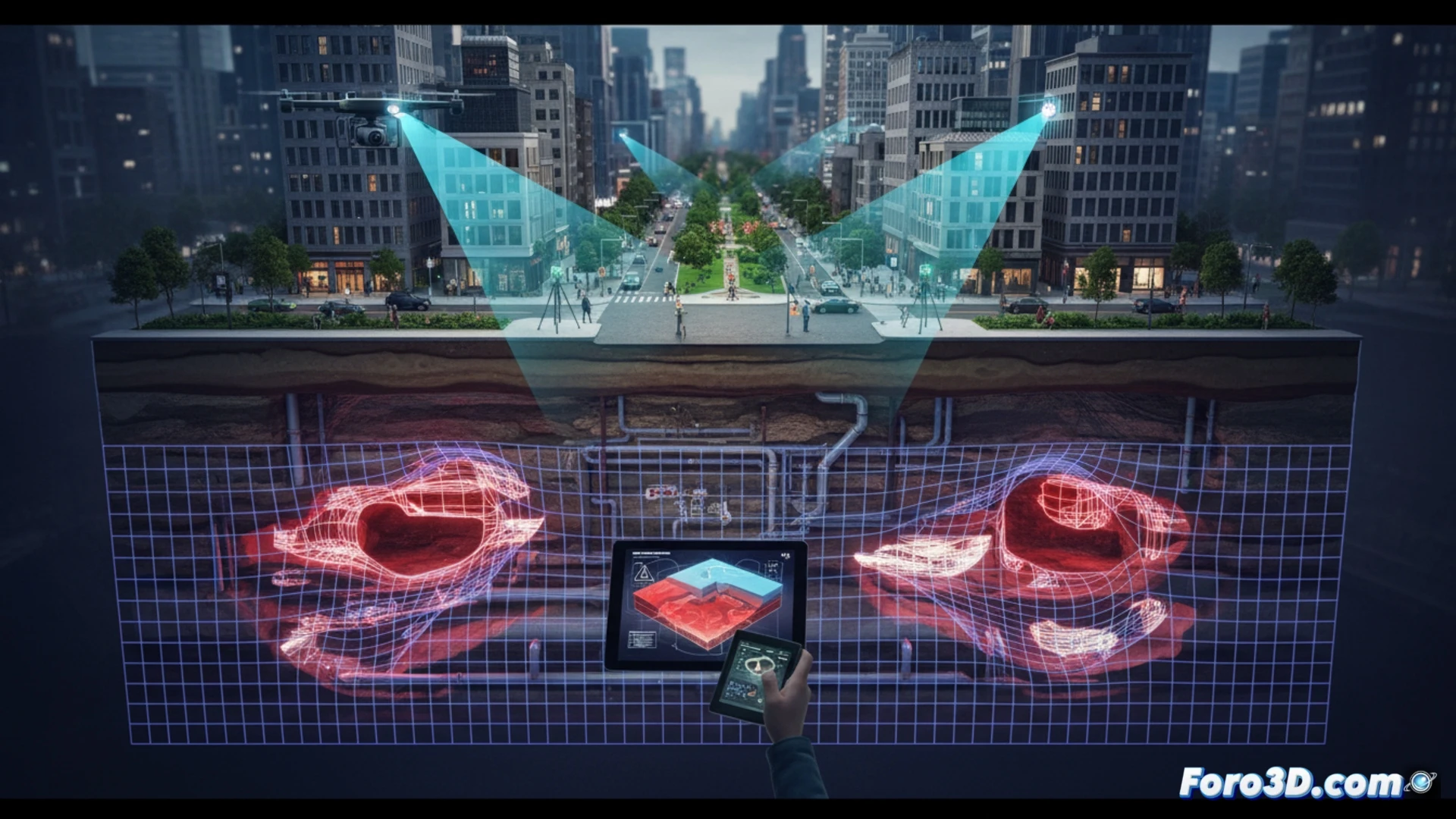
The technical process begins with LiDAR scanning mounted on drones or ground vehicles, which emits laser pulses capable of penetrating vegetation and generating point clouds of the terrain. These clouds are merged with high-resolution photogrammetry models to create an exact digital twin of the surface. Differential analysis between the current model and the historical one allows identifying anomalous subsidence or depressions that betray illegal tunnels. Subsequently, geotechnical simulation software evaluates terrain stability, calculating the risk of imminent collapse and generating hazard heat maps. This 3D documentation is admissible as expert evidence in legal proceedings against those responsible for the excavation.
Prevention and justice: the role of 3D simulation ⚖️
Beyond detection, 3D simulation allows recreating disaster scenarios to train emergency teams without risking human lives. A digital twin of the subsurface can run hundreds of collapse variations, showing the safest evacuation routes or critical shoring points. In the judicial sphere, 3D forensic animation transforms technical data into visual evidence understandable for judges and prosecutors, closing the loop between technology, disaster prevention, and criminal liability.
Which subsurface 3D modeling techniques allow detecting illegal excavations with greater precision before they cause a catastrophic urban collapse?
(PS: Simulating catastrophes is fun until the computer crashes and you are the catastrophe.)