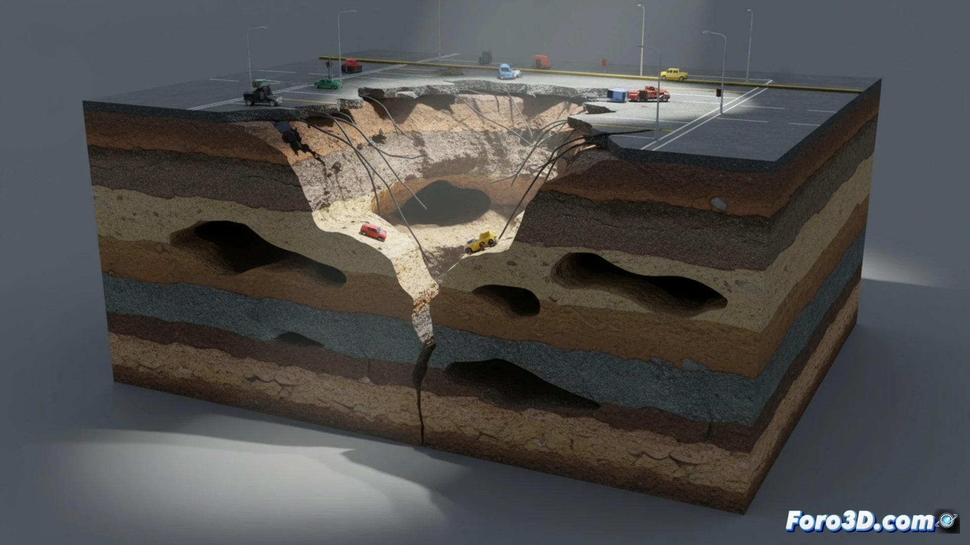
The sinkhole on Main Avenue is not just a hole in the asphalt; it is a fracture in the integrity of the subsoil that demands a deep analysis. From a geotechnical engineering perspective, this phenomenon represents a catastrophic failure where the ground suddenly loses its bearing capacity. Using 3D modeling tools, we can virtually reconstruct the site's stratigraphy to understand the soil layers, identify pre-existing cavities, and visualize the exact point of rupture, offering a perspective that aerial photography could never reveal.
Three-Dimensional Reconstruction of Stratigraphy and Underground Flow 🌊
To simulate the progression of the collapse, it is crucial to generate a digital twin of the subsoil. This volumetric model integrates ground-penetrating radar data and boreholes to map the network of sewage pipes, groundwater aquifers, and potential zones of gypsum or limestone dissolution. By applying soil mechanics algorithms in 3D environments, we can reproduce the sequence of events: from the initial water seepage that erodes the ground (piping) to the propagation of the void and the final collapse of the surface slab. The resulting animation allows engineers to assess the residual safety factor and predict whether the sinkhole will expand laterally or if other hidden instability pockets exist beneath the avenue.
Digital Lessons for Disaster Prevention 🛡️
Beyond diagnosis, the 3D model of the sinkhole becomes a prevention tool. By visualizing accumulated stresses and flow patterns, authorities can identify critical points in other city arteries before a new disaster occurs. This approach transforms an isolated catastrophic event into a replicable case study. The simulation not only explains the past but also illuminates future risks, demonstrating that three-dimensional technology is indispensable for managing urban infrastructure in the face of the terrain's whims.
What geotechnical parameters and subsoil conditions must be modeled in 3D to accurately simulate the progression of an urban sinkhole collapse?
(PS: Simulating disasters is fun until the computer crashes and you are the disaster.)