Geothermal faults represent a latent risk in volcanically and tectonically active regions. Their study through 3D modeling allows for anticipating catastrophic events such as landslides or sudden steam emissions. This article explores three-dimensional simulation techniques that transform geological data into precise risk maps, helping to save lives and optimize emergency response.
Simulation of tectonic stresses and thermal flow in 3D 🌋
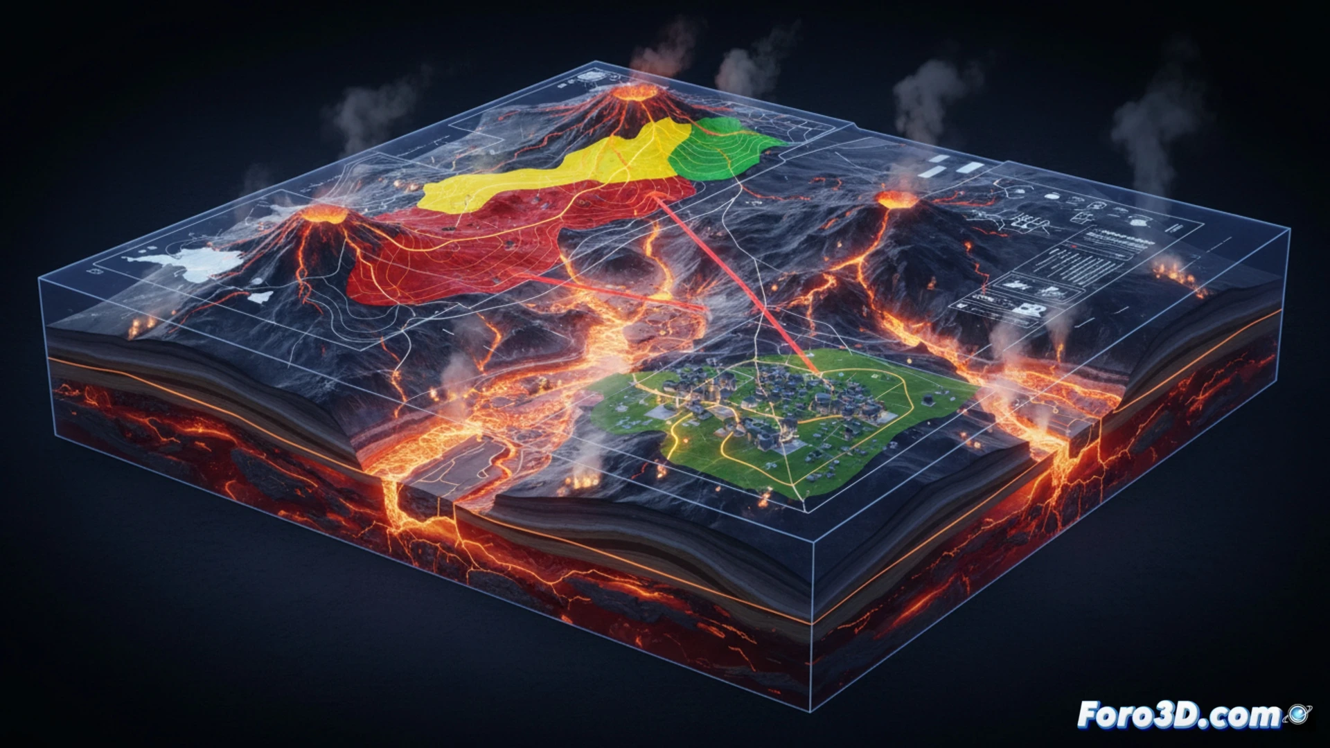
To model a geothermal fault, field seismic and thermal data are used as a starting point. Using finite element software such as COMSOL or specific modules in Blender, a volumetric mesh representing the Earth's crust is constructed. Boundary conditions replicating lithostatic pressure and the geothermal gradient are applied. The 3D visualization of stress vectors and slip surfaces allows for identifying critical rupture points. Furthermore, the animation of hot fluid flow reveals how heat migrates toward the surface, indicating areas of potential phreatic eruption or ground deformation.
Predicting disaster to mitigate impact ⚠️
3D simulation is not only a technical tool but also a bridge between geology and civil protection. By visualizing scenarios of collapse or thermal energy release, emergency teams can design evacuation plans and reinforce infrastructure in high-risk areas. Reflecting on these models reminds us that technology, applied rigorously, turns the invisible threat of a geothermal fault into a measurable and, therefore, preventable hazard.
How can 3D modeling of geothermal faults accurately anticipate the critical rupture point to prevent disasters in urban areas near active volcanoes
(PS: Simulating catastrophes is fun until the computer melts down and you are the catastrophe.)