Illegal logging represents an evidentiary challenge in environmental courts, where physical evidence degrades rapidly. The use of 3D mapping techniques allows freezing the ecological crime scene in a precise digital model. This article breaks down the forensic workflow, from drone capture to generating a digital twin of the forest, designed to support irrefutable technical expert testimony.
Workflow: Capture, Processing, and Volumetric Analysis 🛠️
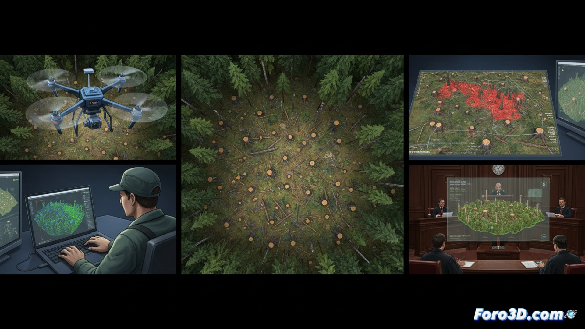
The process begins with a programmed drone flight with 80% frontal overlap and 70% lateral overlap to cover the deforested area. High-resolution images of the stumps and cut marks are captured, using ground control points to georeference the model. Photogrammetry software processes the images to generate a dense point cloud and an orthomosaic. The critical phase is segmentation: individual stumps are isolated to measure their diameter and height, calculating the volume of extracted wood by comparison with a reference digital terrain model from before the crime.
The Digital Twin as Incontrovertible Expert Evidence 🌲
The final product is a digital twin of the logged area, integrated into an interactive 3D viewer. This model allows the judge or prosecutor to virtually tour the scene, observe the orientation of the saw marks, and verify volumetric measurements. The chain of custody of the digital file, including the metadata of the original images and the drone calibration reports, is essential to ensure the admissibility of the evidence in an environmental lawsuit.
How can aerial drone photogrammetry overcome chain of custody and evidentiary degradation in an environmental court for illegal logging cases in hard-to-reach areas
(PS: don't forget to calibrate the laser scanner before documenting the scene... or you might be modeling a ghost)