Forest disaster management has found an unexpected ally in 3D visualization. Today, the concept of Digital Tree Damage refers to the ability to quantify, using LIDAR sensors and photogrammetry, the real impact of fires or hurricanes on each tree. This approach allows moving from subjective estimates to precise volumetric models that reveal biomass loss and the structural integrity of the forest.
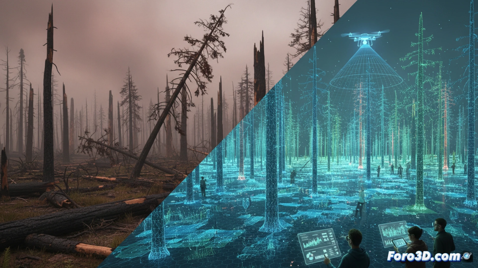
Capture methodology: from point cloud to digital twin 🌲
The process begins with drone flights equipped with discrete return LIDAR scanners. These emit laser pulses that penetrate the tree canopy, generating point clouds that differentiate the ground from foliage and trunks. Subsequently, 3D reconstruction software segments each individual tree. In burned areas, this model is compared with previous data or with algorithms that detect the absence of canopy or anomalous trunk tilt. Precision reaches the centimeter level, allowing calculation of the volume of lost wood or the risk of imminent fall.
Predictive simulation: reforest before the disaster occurs 🔥
Beyond assessing damage, the technology allows simulating scenarios. By introducing variables such as hurricane winds or fire fronts into a digital twin, forest managers can identify areas of high structural risk. This advanced planning guides strategic reforestation, selecting species that mitigate the impact of future storms. Thus, Digital Tree Damage not only documents the tragedy but becomes an active tool for designing more resilient forests in the face of climate change.
How forest digital twins can predict the evolution of tree damage over time after a catastrophe, and how this 3D simulation improves decision-making for ecosystem recovery
(PS: Simulating disasters is fun until the computer crashes and you are the disaster.)