When a communications satellite fails, we don't just lose television signal. We lose the ability to coordinate firefighters during a wildfire, to receive a tsunami alert, or to guide a rescue team in an earthquake-devastated area. In the world of 3D simulation, this scenario is modeled as a critical blind spot that can turn a controllable disaster into a total catastrophe.
3D Simulation of Coverage and Coordination Loss 🛰️
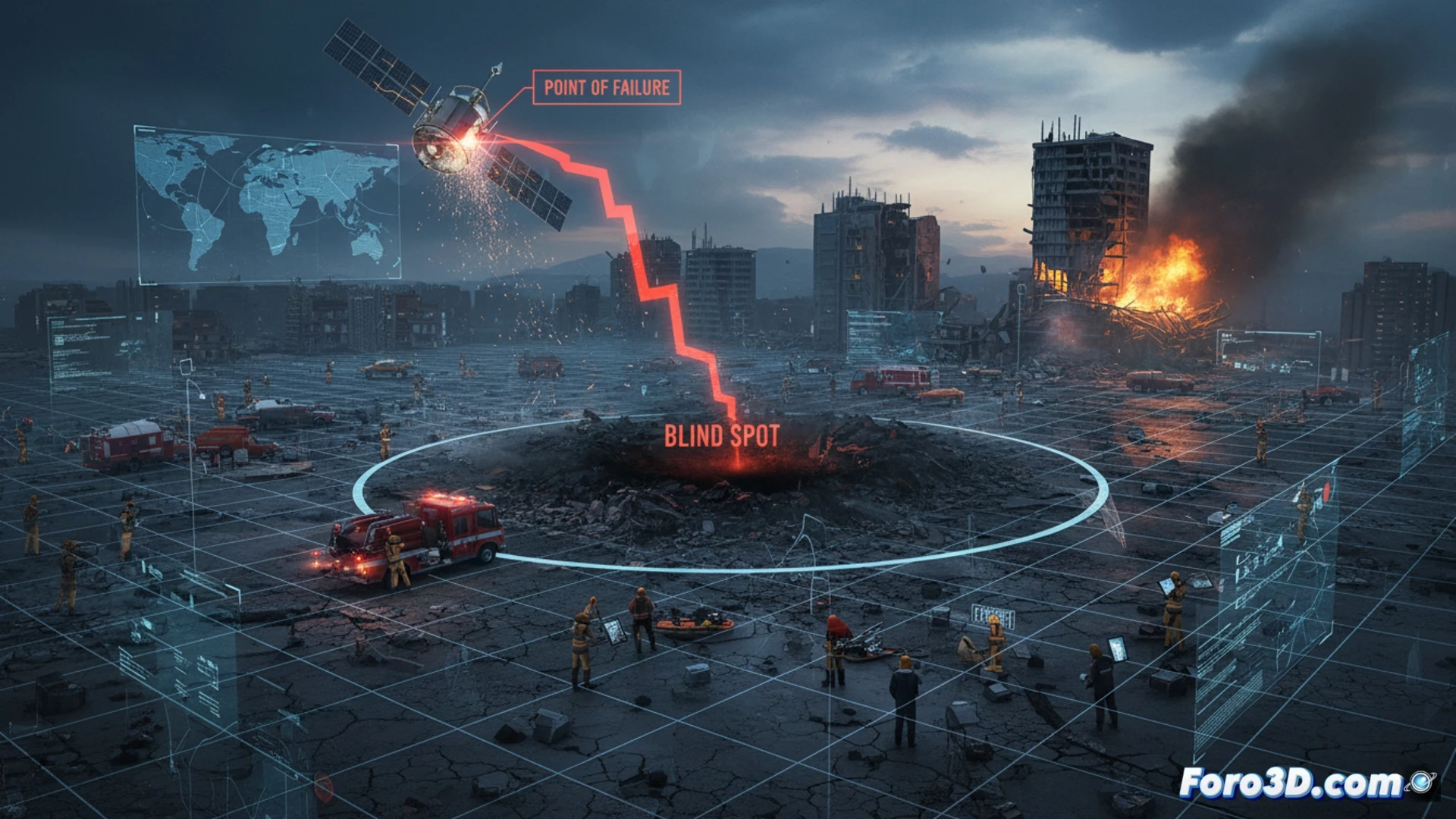
To visualize the impact, we model an earthquake scenario in a coastal region. Our 3D simulation shows a mesh of communication points (towers, drones, and satellites). When the main satellite fails, the mesh disintegrates. Coverage zones shrink to isolated islands. Rescue teams on the ground, represented as nodes on the 3D map, lose contact with the command center. The data flow from seismic sensors is interrupted, delaying the alert for aftershocks or secondary tsunamis. The visualization allows identifying critical points where redundancy (such as balloons or relay drones) must be implemented to maintain system integrity.
Lessons for a Resilient Future 🌍
The simulation not only shows the problem but also proposes solutions. By modeling a satellite failure, we discover that dependence on a single constellation is an unacceptable risk. Redundancy must be physical (backup satellites) and structural (offline communication protocols). At Foro3D, we believe that anticipating these failures in a virtual environment is the only way to ensure that when technology fails, the human response does not. Prevention is the best rescue.
How could technological dependence on a single satellite system turn a natural disaster into a total collapse of emergency coordination?
(PS: Simulating catastrophes is fun until the computer crashes and you are the catastrophe.)