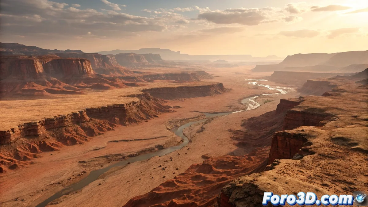
When Mars Had More Water Than the Atacama Desert
Recent discoveries of ancient Martian rivers stretching over 15,000 km are revolutionizing our understanding of the red planet. For 3D artists, this represents a fascinating challenge: recreating landscapes that haven't existed for millions of years.
From Satellite Data to 3D Model
- Data Sources
- Images from the Mars Reconnaissance Orbiter
- NASA Elevation Maps (DEM)
- Mineralogical data from Curiosity
- 3D Reconstruction
- Photogrammetry with RealityCapture
- Height maps in Substance Designer
- 32-bit Displacement maps for maximum precision
Advanced Techniques for Martian Rivers
- Procedural Erosion in Houdini
- FLIP Simulations for historical water flows
- Custom Shaders for hydrated minerals
- Realistic Atmosphere with volumetrics in Unreal Engine 5
Mistakes That Give Away Your Fictional Mars
| Common Error | Professional Solution |
|---|---|
| Terrain too smooth | Use high-resolution displacement maps |
| Uniform red color | Vary tones with mineral masks |
| Earthly erosion patterns | Study real Martian forms |
This aqueous Mars from the past reminds us that even the driest planets can have wet histories. Although if your render ends up looking like the Grand Canyon with a red filter, you might need to check your scientific references.