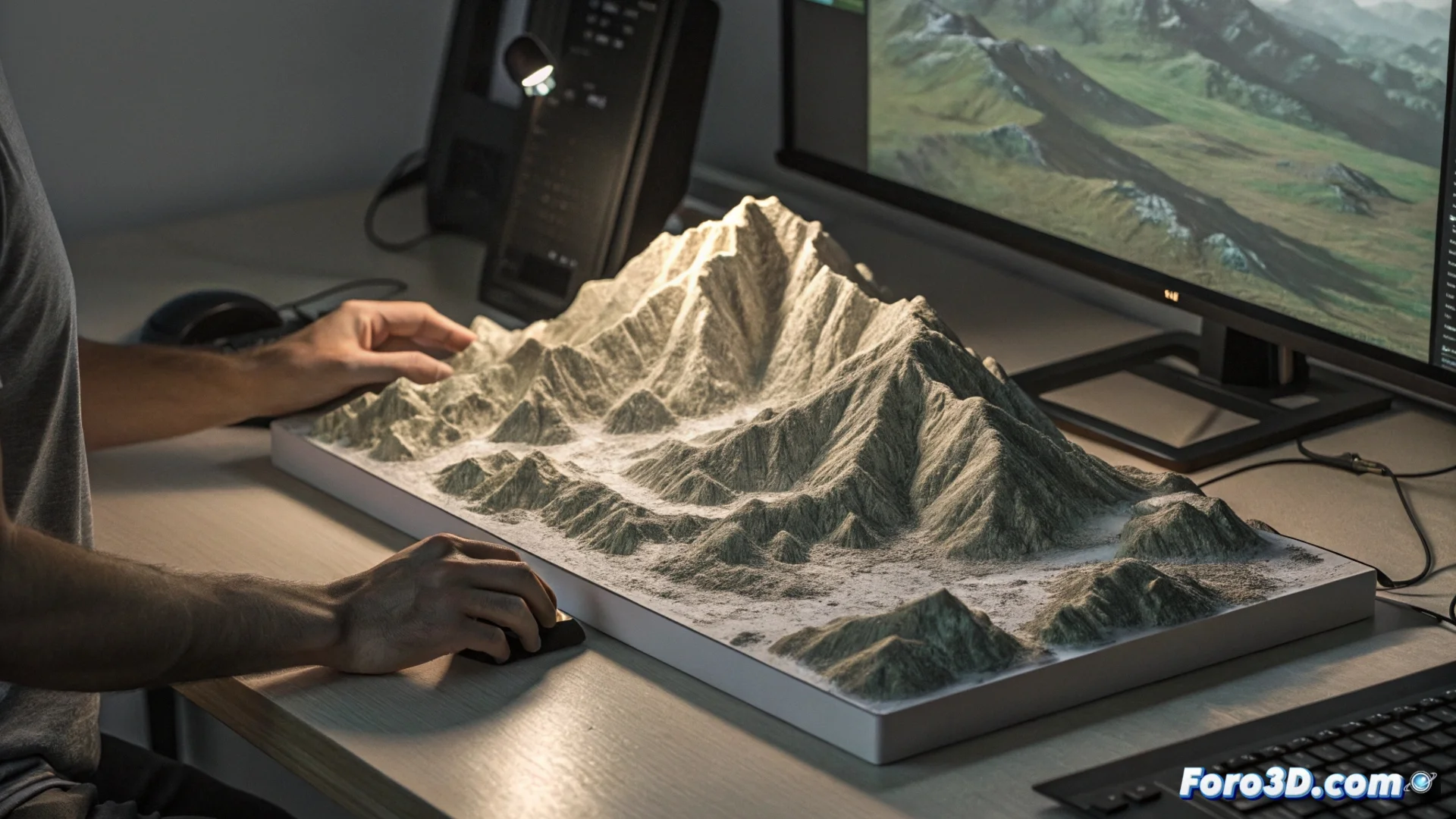
TouchTerrain: Generate Printable 3D Digital Terrain Models
This online tool democratizes access to the creation of physical representations of any landscape on the planet. With just a few clicks, you can transform public elevation data into a 3D file ready for printing, eliminating the need to know how to use complex geographic information system software. 🌍
The Workflow to Create Your Model
The process begins on its website, where you interact with a global map. You draw a polygon to mark the area of interest, whether it's a mountain range, a volcano, or your city. Then, you define key parameters that determine how the final physical object will be.
Essential Parameters You Can Configure:- Physical Size: Define the maximum dimensions in centimeters that the printed model will have.
- Mesh Resolution: Controls the level of terrain detail; higher resolution captures finer reliefs but generates heavier files.
- Vertical Exaggeration: A factor that accentuates the height of mountains and the depth of valleys to make the relief more visible to the touch.
TouchTerrain processes satellite data like SRTM or ASTER, converting abstract geographic information into a tangible object you can hold in your hand.
What Is a 3D Terrain Model Used For?
The applications are very varied and go beyond the realm of simple hobby. This technology allows materializing geographic concepts and using them in educational, professional, or creative contexts immediately.
Practical Uses and Benefited Sectors:- Education: Teachers and students use these tactile models to learn about geomorphology, hydrography, and geological processes directly.
- Research and Planning: Geologists, architects, and urban planners visualize field data or integrate real relief into their designs and studies.
- Personal Creation: Tabletop gaming enthusiasts, decoration, or model makers create scenarios and pieces based on real locations with a high degree of fidelity.
Final Considerations and a Touch of Reality
While the tool greatly simplifies the technical process, the final success depends on your 3D printer. The challenge shifts from generating the digital model to ensuring a reliable print. It's ironic that replicating the majesty of the Himalayas in miniature can depend on the last layer of filament not failing, turning a technological achievement into a small domestic drama. 🏔️