TouchTerrain: Create 3D Terrain Models for Printing
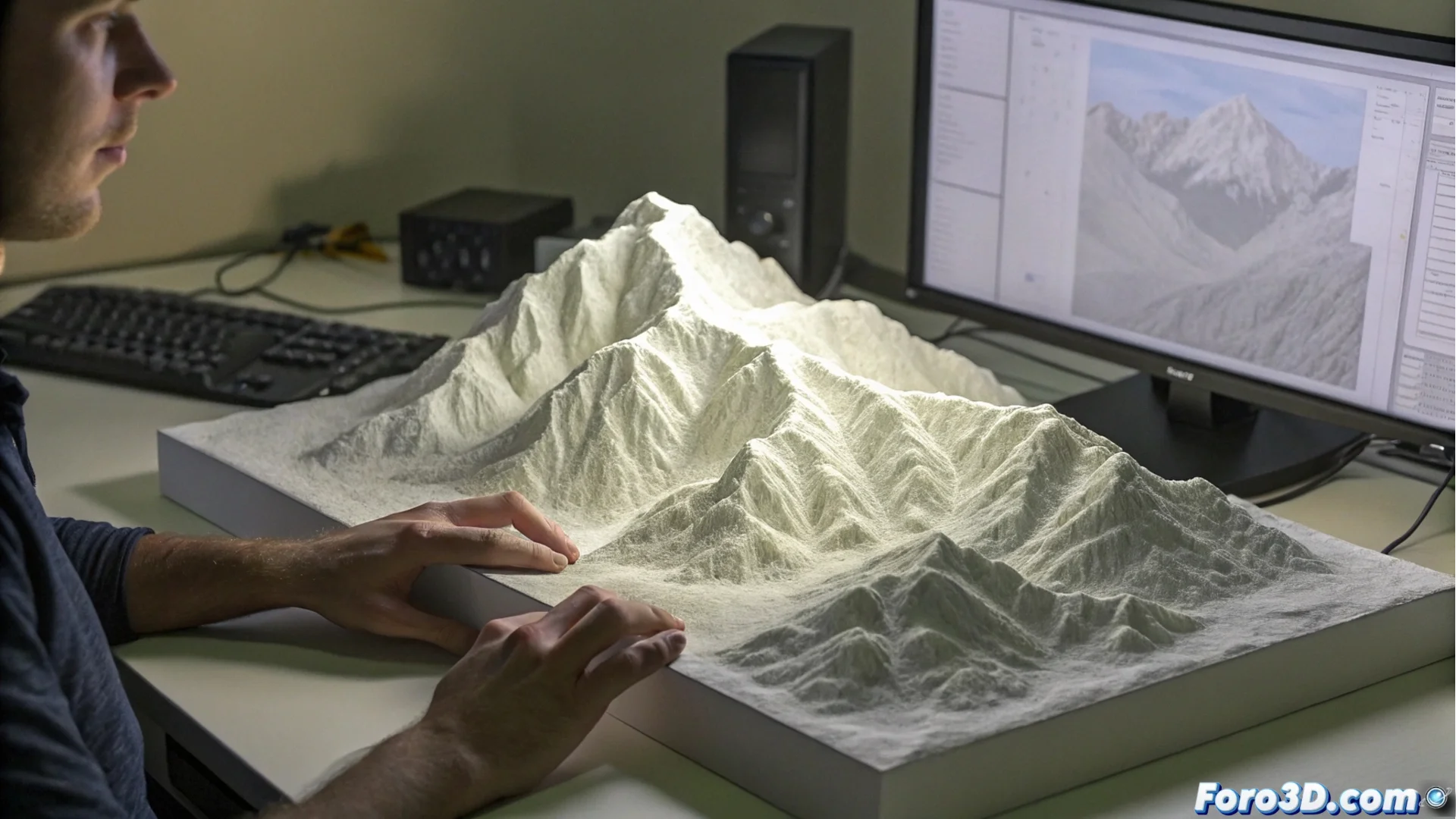
Do you need a physical model of a volcano, a mountain range, or your favorite coastline? TouchTerrain is a web tool that converts global topographic data into 3D files ready for printing. It works directly from your browser, eliminating the need to use complex GIS software. 🗺️
A Tool to Make Geography Tangible
This platform processes elevation data, such as that provided by NASA, and transforms it into 3D meshes in STL or OBJ formats. Its main advantage is accessibility: anyone can generate an accurate representation of a terrain in just a few steps. It is especially valuable for visualizing and communicating spatial concepts in a concrete way.
Main uses of the generated models:- Education: Create tactile aids to explain geology or geography in classrooms.
- Research: Visualize field data, plan expeditions, or present findings.
- Hobbies and art: Design terrains for board games, dioramas, or model projects.
TouchTerrain brings the world's topography to your desk, allowing you to explore mountains and valleys from the palm of your hand.
How the Creation Process Works
The interface guides the user intuitively. No program installation is required, as everything runs online. The workflow is designed to be straightforward and customizable, adapting the final model to the specific needs of each project.
Steps to generate your model:- Select the area: Navigate an interactive map and delineate the area of interest.
- Adjust parameters: Define the vertical scale to exaggerate relief, base size, or crop edges.
- Optimize and download: The tool processes the data, simplifies the mesh to make it printable, and generates the 3D file for download.
From Browser to 3D Printer
Once the STL or OBJ file is downloaded, you only need to use a slicer to prepare the print. TouchTerrain ensures the mesh is viable, reducing triangles in flat areas to save time and material. This tool democratizes access to physical topographic models, whether to study Everest or recreate the local landscape. 🏔️