Alice Reaches the Mediterranean with Bad Intentions
Storm Alice, a low-pressure system that has been developing in the Atlantic, begins its eastward movement with a clear course towards the Spanish Mediterranean coast. Meteorological services have activated warnings for possible torrential rains that could especially affect the Valencian Community, Catalonia, and the Balearic Islands over the next 48 hours. Predictive models show accumulations that could exceed 200 liters per square meter in specific areas.
What makes Alice particularly concerning is its combination of cold air aloft with the still-warm temperatures of the Mediterranean Sea, creating perfect conditions for developing deep convection and organized thunderstorms. The phenomenon is amplified by the coastal orography, which forces the ascent of moist air and enhances the formation of vertically developing clouds. Authorities recommend special caution in urban areas due to the risk of flash floods.
Alice isn't coming for a visit, she's coming to stay... and to leave her calling card in the form of water
Preparing the Cartographic Base
The visualization begins with an accurate geographic base of the Iberian Peninsula and the Balearic Islands. Using digital elevation data, a topographic model is created to show the coastal mountainous relief, crucial for understanding how the orography influences the intensification of precipitation. The Mediterranean coast is represented in detail, highlighting the alluvial plains and urban areas most vulnerable to flooding.
The color palette for the terrain uses soft earth tones that do not compete with the overlaid meteorological information. Main hydrographic elements - rivers, reservoirs, and dry riverbeds (ramblas) - are included as a reference to contextualize the risk of sudden flooding. The result is a clean canvas where the evolution of Alice will be the absolute protagonist.
- Import of SRTM elevation data for the terrain
- Modeling of the Mediterranean coastline with high precision
- Delineation of watersheds and river networks
- Selection of color palette for relief and geographic elements
Representing the Low-Pressure System
The core of Alice is modeled as a spiral structure defined by concentric isobars closing around the low-pressure center. The density of these lines indicates the intensity of the pressure gradient, showing areas of stronger winds. The cyclonic rotation movement is represented by flow arrows following the counterclockwise direction characteristic of low-pressure systems in the Northern Hemisphere.
The temporal evolution is shown through an animated sequence where the system moves from the southwest to the northeast, interacting with the Mediterranean coast. The deepening of the storm is indicated by the increase in isobar density and the expansion of the radius of influence as Alice absorbs energy from the sea.
- Creation of isobars with variable spacing according to intensity
- Animation of the low-pressure center displacement
- Representation of the wind field with tracer particles
- Indication of temporal evolution with a progression scale
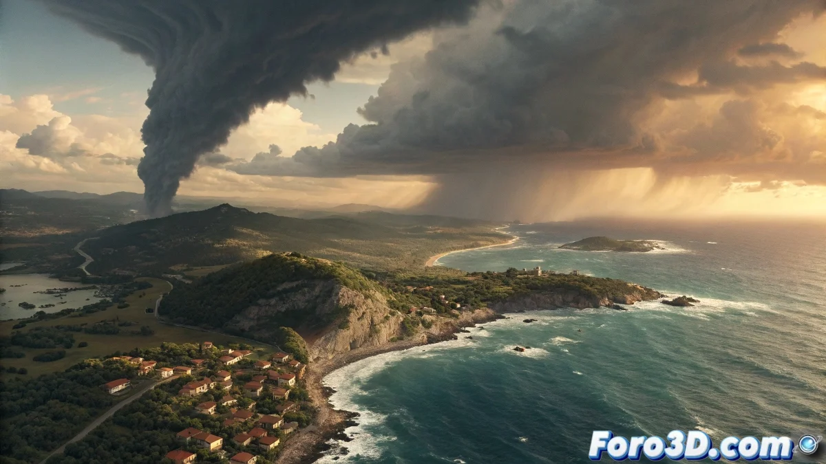
Visualization of Cloud Mass and Precipitation
Cloud formations are represented using semi-transparent volumes that show the three-dimensional structure of the system. The vertically developing cumulonimbus clouds, responsible for the most intense rains, are highlighted with greater opacity and height. The animation shows how these clouds preferentially develop over the sea at night and move towards the coast during the day.
Precipitation is visualized using a particle system that simulates rainfall, with variable density and intensity according to radar data. Areas of greater accumulation are highlighted with colors ranging from light blue for moderate rains to deep red for torrential precipitation. This information layer is dynamically overlaid on the underlying geography.
Effects of Land-Sea-Atmosphere Interaction
The visualization captures the key physical processes that intensify the rains. The thermal contrast between the warm sea and the cold air aloft is represented by color gradients at the sea-atmosphere interface. The orographic effect is shown by particles ascending the mountain slopes and condensing, forming stagnation clouds on the windward slopes.
The coastal convergence processes,