Sernageomin Incorporates 3D Scanning to Map Mining Deposits
The National Geology and Mining Service of Chile, Sernageomin, takes a technological leap by adopting XGrid three-dimensional scanning systems. This tool enables mapping mining deposits and tailings with unprecedented detail, transforming how terrain is perceived and analyzed. 🏔️
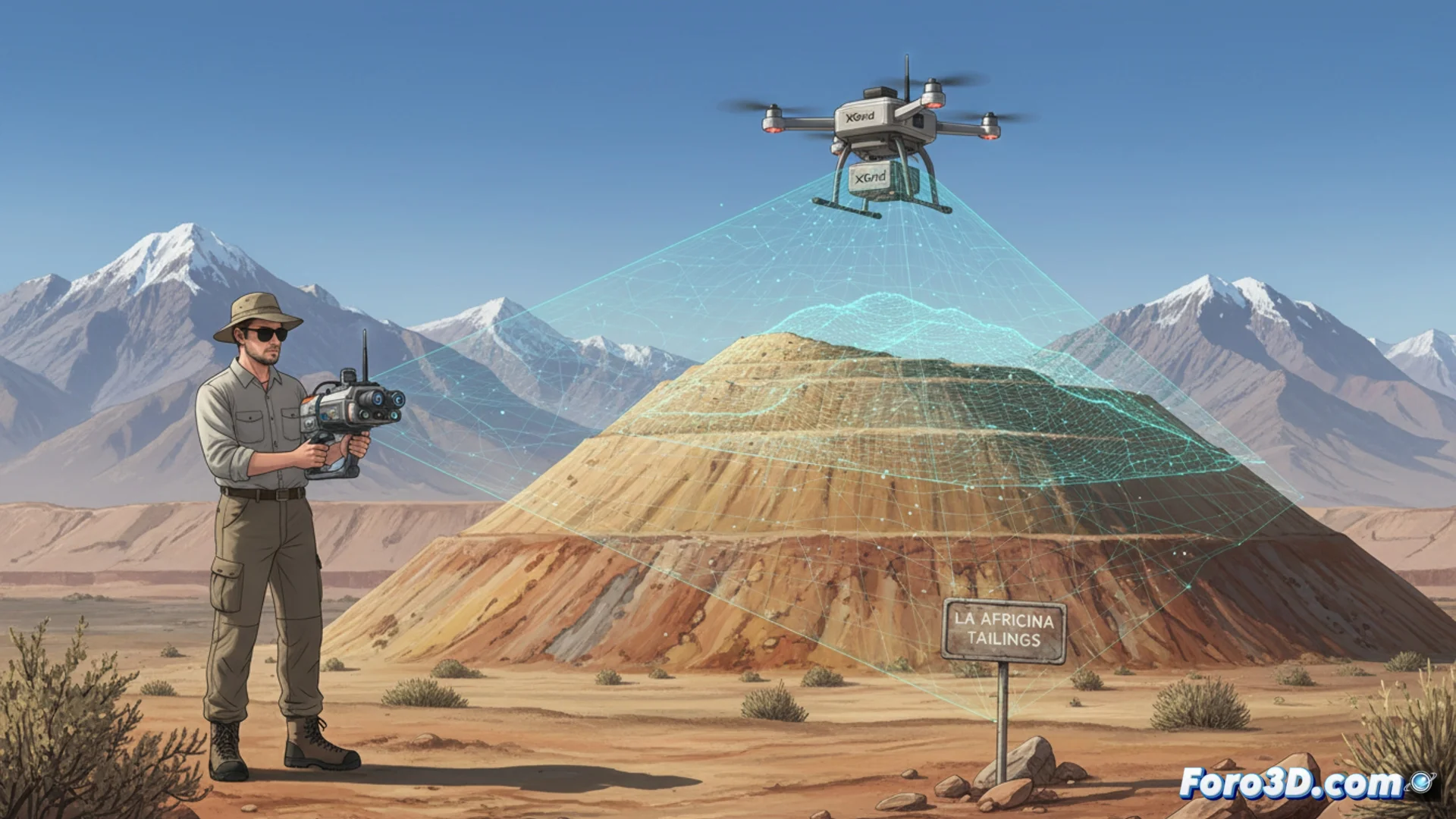
On-Site Training for Precise Digital Models
The agency is already training its team of geomechanics professionals directly in the field, focusing on sites like the La Africana tailings deposit. The central purpose is to generate 3D digital models that strengthen technical analysis and optimize decision-making processes. These models are more than visualizations; they are the foundation for modern mining.
Key Advantages of XGrid Technology:- Allows high-precision mapping of complex geological structures.
- Facilitates creating exact digital replicas of deposits and tailings areas.
- Streamlines the workflow from data capture to analysis.
Now specialists can debate whether a 3D model is geometrically impeccable or just an attractive set of points.
Strengthening Safety Supervision and Risk Assessment
These high-fidelity 3D models are crucial tools for supervising safety and assessing risks in mining infrastructure. The system stands out for its versatility: it can be operated manually, mounted on vehicles, or integrated into drones. This flexibility speeds up inspections by covering large areas and hard-to-reach locations. 🚁
System Operation Modes:- Manual operation for detailed and focused inspections.
- Vehicle mounting to cover considerable terrain extensions.
- Drone integration to reach and scan remote or dangerous areas.
A Technical Benchmark for Global Mining
This modernization aims to position Sernageomin on par with global mining industry standards. By implementing these advanced tools, the service consolidates its role as the technical authority in Chilean mining. The ability to produce detailed geomechanical data and precise models is a pillar for responsible and sustainable mining. This advancement not only improves oversight but also establishes a new paradigm in mining control and planning. ⚙️