Sernageomin Adopts 3D Scanning to Monitor Mining Deposits
The National Geology and Mining Service of Chile has integrated an advanced 3D laser scanning solution into its inspection processes. This innovation, called XGrid, transforms how the agency analyzes and controls mineral deposits and tailings during field visits. The deployment began with a training session at the La Africana deposit, where a team of geomechanics experts was instructed in the use of this high-precision tool. 🏔️
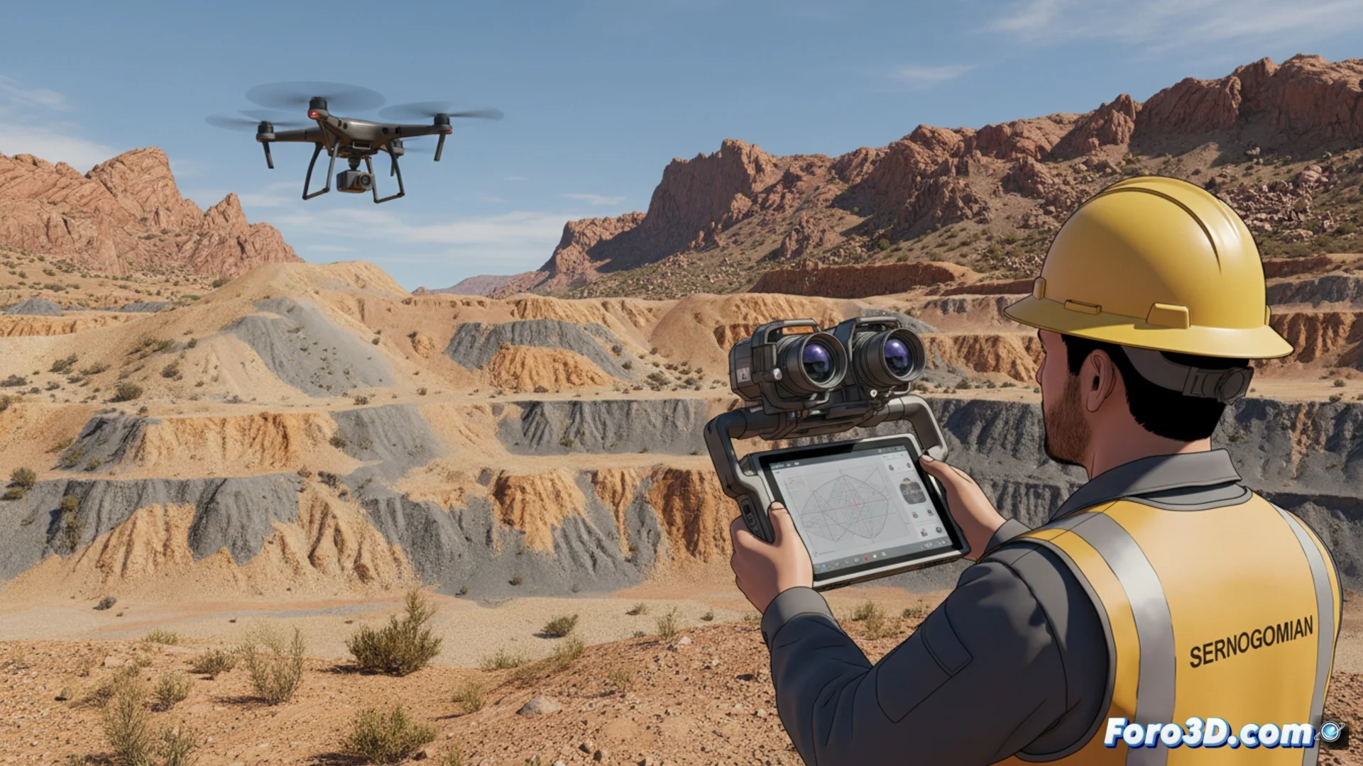
XGrid Technology Builds Detailed Spatial Representations
The XGrid system collects environmental information to generate comprehensive three-dimensional models of mining infrastructures. These digital representations help make more informed technical decisions and refine protocols for managing risks and ensuring safety. Its design is flexible: it can be used manually, installed on vehicles, or attached to drones to reach remote areas or complex topography.
Main operational advantages:- Create precise 3D models that serve as an objective basis for evaluating deposits.
- Optimize safety plans and procedures for handling geotechnical risks.
- Access and scan areas that are difficult or dangerous for personnel to reach.
Now specialists can analyze the stability of a slope with a digital model on screen, without having to physically climb to the summit in adverse weather conditions.
Strengthens the Institution's Technical Capabilities
By incorporating this technology, Sernageomin consolidates its capacity to technically analyze and manage the mining sector in Chile. The 3D models provide measurable and accurate data on the state of deposits, enabling more rigorous inspections and better-supported planning. This action is part of an ongoing effort to integrate innovative solutions into the state's supervision tasks.
Impact on field work:- Strengthen technical analysis with precise and quantifiable spatial data.
- Conduct more thorough supervisions based on digital evidence.
- Continuously incorporate technological innovation into inspection processes.
A New Standard for Mining Inspection
The adoption of three-dimensional scanning marks a turning point in how the extractive industry is supervised. It not only streamlines fieldwork but also establishes a new paradigm of precision and safety. Geomechanics experts have a powerful tool that reduces subjectivity and operational risks, while laying the foundation for more modern and controlled mining. 🔬