Digitally Rescuing a Lost Civilization
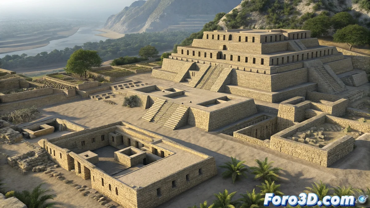
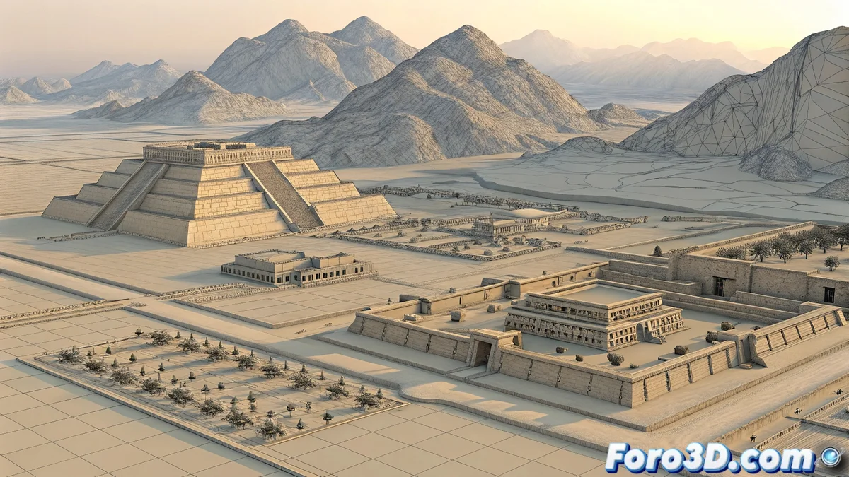
An extraordinary archaeological discovery has come to light in Peru: the remains of an ancient city approximately 3,500 years old that reveals an organized and technologically advanced society predating the Inca civilization. 🏔️ The complexity of its architecture, which includes temples, squares, and homes, suggests a level of development that challenges our understanding of pre-Columbian societies in America. This finding becomes a key piece in reconstructing the puzzle of Andean cultural development.
For 3D modelers and enthusiasts of digital archaeology, this discovery represents a fascinating opportunity to explore techniques for historical reconstruction in SketchUp. 🏗️ The digital recreation of this lost city allows not only visualizing its possible original appearance, but also studying its urban organization and construction techniques. The combination of architectural modeling tools, application of historical textures, and carefully studied lighting can transport us directly to this millennial settlement.
A digital window into pre-Columbian urbanism that challenges established timelines.
Modeling Techniques for Pre-Columbian Architecture
The recreation in SketchUp begins with meticulous historical research into construction techniques and materials available 3,500 years ago. 📐 Setting units in meters is crucial to maintain realistic architectural proportions. The modeling must capture not only the basic shapes of temples and homes, but also the specific characteristics of pre-Columbian architecture, such as dry-stone walls assembled without mortar and roofs made of organic materials.
The essential elements to faithfully recreate the city include:
- Ceremonial temples with stepped platforms
- Central squares as gathering spaces
- Grouped homes with internal patios
- Terrace systems adapted to the Andean terrain
Lighting and Andean Geographic Context
Lighting is fundamental to convey the unique atmosphere of the Peruvian Andes. ☀️ Natural sunlight must be configured simulating the specific geographic position of the discovery, considering the altitude and latitude that characterize this region. The pronounced shadows and intense light angles typical of the Andean mountain range help create depth and realism, while warm tones in color correction reinforce the sense of historical authenticity.
It's funny to think that this city survived thousands of years buried, while we still get lost on Google Maps even walking through our own city. 🗺️ A modern irony that reminds us how ephemeral our technologies can be compared to the permanence of constructions that, though forgotten, withstood the passage of millennia.