Radar2Shape: 3D Reconstruction with Artificial Intelligence and Radar Signals
The Radar2Shape technology marks a milestone in generating three-dimensional models using advanced artificial intelligence, leveraging high-frequency radar signals even with limited information or reduced viewing angles. 🚀
Technical Foundations of the System
This innovative model applies a diffusion process that methodically associates radar frequencies with geometric attributes at multiple resolution levels, enabling the creation of faithful representations without relying on complete visual data. The methodology overcomes conventional barriers of direct perception, enabling operations in scenarios with visibility obstructed by physical elements or adverse environmental conditions. 🌫️
Key Aspects of Radar2Shape:- Integration of radar signals with diffusion algorithms to correlate frequencies and morphological characteristics
- Ability to work with partial or incomplete data, reconstructing complex geometries from limited perspectives
- Generation of precise 3D models without the need for direct line of sight or exhaustive visual information
Accurate reconstruction of complex shapes from partial data significantly improves real-time decision-making, reducing risks and increasing operational reliability.
Applications in Autonomous Vehicles and Unmanned Aerial Systems
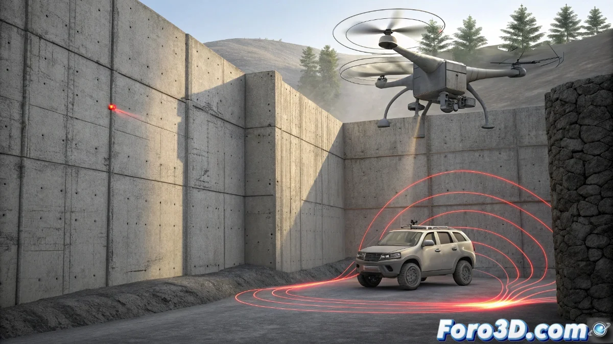
In the field of autonomous navigation, Radar2Shape equips vehicles and drones with the ability to detect and model objects hidden behind barriers such as smoke, thick fog, or thin partitions, processing radar signals exclusively. This functionality produces detailed three-dimensional models that optimize safety in movements where traditional optical systems fail. 🛸
Operational Advantages:- Enhanced perception of hidden obstacles in environments with compromised visibility
- Real-time reconstruction of complex shapes from fragmented information
- Increase in operational reliability in dynamic and potentially dangerous contexts
Uses in Industrial Sectors and Infrastructure Evaluation
Industrial applications are enhanced with this technology, especially in technical inspections where comprehensive visual access is unfeasible or risky. Radar2Shape facilitates the mapping of intricate structures such as airplanes, metal deposits, or mechanical components without physical contact or direct line of sight. This not only elevates efficiency in maintenance and quality control but also protects personnel by minimizing their exposure to hostile environments. 🏭
Methodological Transformations:- Non-invasive mapping of complex structures using radar signals
- Reduction of workplace risks in inspections in hazardous environments
- Evolution of traditional methodologies for evaluation through 3D reconstruction from incomplete data
Future Perspectives and Reflections
Imagining locating car keys behind a wall using only the radar of a mobile device illustrates the everyday potential of this technology, although currently specialization is required to interpret the results. Radar2Shape not only expands the frontiers of three-dimensional reconstruction, but also redefines perception paradigms in challenging environments, establishing itself as a pivotal tool for autonomous and industrial applications. 🔑