Mapping the Ghost Island of Poveglia with GstarCAD: Legacy of Plague and Madness
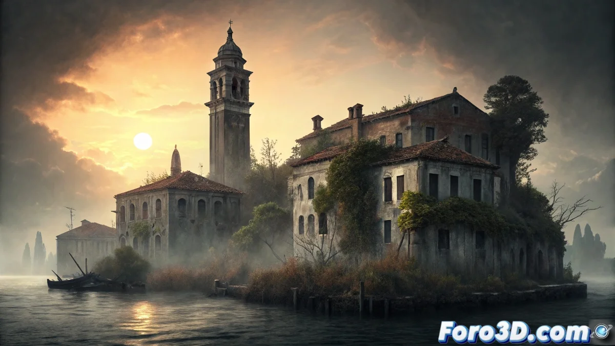
The Poveglia island in the Venice lagoon represents one of Europe's most intense historical horror epicenters. This small island of just 7 hectares served as a lazaretto for bubonic plague victims for centuries, where it is estimated that more than 160,000 people died and were buried or incinerated. In the 20th century, it became a psychiatric hospital where rumors circulate of brutal medical experiments and a doctor who committed suicide by throwing himself from the bell tower. The ground is literally saturated with human ashes and visitors report ghostly voices, apparitions, and an oppressive feeling of despair that permeates every structure. 🏝️
The Stratification of Horror Through the Centuries
What makes especially terrifying about Poveglia is the historical accumulation of suffering. The island functioned as a quarantine colony from 1793 to 1814, then as a maritime quarantine station and finally as a geriatric and psychiatric hospital until 1968. Each historical layer added new layers of trauma to the soil already contaminated by centuries of plague deaths. Documented rumors speak of a doctor who performed lobotomies and other experimental procedures on psychiatric patients, adding iatrogenic horror to the already existing epidemic horror.
Historical Layers of Poveglia:- Plague lazaretto (16th-18th centuries) - 160,000+ estimated deaths
- Maritime quarantine station (19th century)
- Psychiatric and geriatric hospital (1922-1968)
- Complete abandonment from 1968 to present
"In Poveglia, the earth itself seems to remember every cry of pain, every plague fever, and every brutal procedure, creating a palimpsest of horror where the past never finishes dying"
Project Setup and Georeferencing in GstarCAD
Start GstarCAD and set up a new topography project with real coordinates of the island in the Venice lagoon. Use the georeferencing tools to establish the exact location (45°22'50"N 12°19'50"E) and the precise scale of the 7.25-hectare island. Import or create the basic topography using contour lines and elevation quotes. Establish organized layers for: topography, historical buildings, ruined infrastructure, context elements, and historical annotations.
Initial Drawing Setup:- UTM coordinate system for topographic precision
- 1:500 scale for building and structure detail
- Layers separated by historical periods and structure types
- Line styles and colors to differentiate states of conservation
Modeling the Decaying Historical Structures
Use GstarCAD's 2D and 3D drawing tools to recreate Poveglia's characteristic structures. Start with the main hospital building, a multi-wing complex that combined psychiatric and geriatric functions. Draw the octagonal bell tower from which the doctor allegedly committed suicide. Include the remains of the lazaretto and mass burial areas. Use discontinuous line styles to represent collapsed sections and restricted access areas due to structural danger.
Architectural Elements to Model:- Main hospital building with E-shaped wings
- 5-story octagonal bell tower
- Auxiliary structures and morgue
- Docks and piers in a state of abandonment
Technical Documentation of Conservation Status
Apply GstarCAD's annotation and measurement tools to document the deterioration of the structures. Use precise quotes to record structural cracks, collapses, and partial collapse areas. Create a conservation status legend using colors and shading patterns to indicate different levels of deterioration. Include technical notes on construction materials and historical Venetian construction techniques.
Deterioration Documentation:- Cracks and structural damage map with measurements
- Soil contamination areas due to human remains
- Conservation status of facades and ornamental elements
- Access routes and structural danger zones
Analysis of Flows and Historical Circulation
Use GstarCAD's spatial analysis capabilities to study the historical circulation patterns within the island. Draw flow diagrams showing how patients, doctors, and bodies moved through the different eras. Analyze the spatial segregation between quarantine areas, medical zones, and burial spaces. This analysis helps understand how the architecture facilitated (or intensified) human suffering in each historical period.
Historical Circulation Analysis:- Routes for transporting plague-infected patients
- Mobility circuit within the psychiatric hospital
- Body flows to burial and incineration areas
- Control and surveillance points within the complex
Final Plans and Digital Preservation of Horror
Generate a complete set of plans documenting the island from multiple perspectives: architectural floor plans, elevations, cross-sections, and 3D views. Include location plans showing Poveglia's relationship with Venice and other lagoon islands. The final GstarCAD project serves not only as technical documentation but as a digital testimony to a place where medical history intertwines with existential horror, creating a spatial legacy of suffering that continues to affect those who venture into its ruins. Modern CAD tools thus become instruments for preserving and analyzing places where the boundary between the physical and the spiritual seems especially thin. 📐