Gpr-slice: processing ground-penetrating radar data to generate time slices
In the field of geophysics, the software Gpr-slice is dedicated to transforming complex ground-penetrating radar data into clear visual information. Its main function is to apply the technique known as time slice or time slice, which produces a two-dimensional representation in a horizontal plane. This image synthesizes how the subsurface responds at a specific depth, helping to discover what is hidden 🔍.
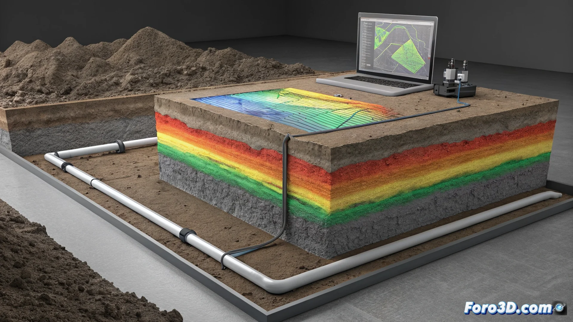
From vertical profiles to interpretable horizontal maps
The process begins with raw data, which are radar traces or vertical profiles. Gpr-slice takes care of aligning and correcting these profiles. Subsequently, the program extracts the signal amplitude for a specific travel time instant, which relates to an estimated depth. By repeating this operation for all measurement lines, a composite reflectivity map is assembled in the horizontal plane. Areas with high reflectivity are visualized as bright pixels, indicating a possible object or change in materials under the surface.
Key advantages of the time slice method:- Converts complex raw data into intuitive visual maps that can be interpreted more easily.
- Allows isolating and analyzing a specific subsurface layer, offering a plan view at a constant depth.
- The mapped reflectivity serves as a direct guide to identify anomalies without altering the terrain.
The time slice technique transforms radar lines into a plane of discovery, where a bright spot can hide anything from a rock to a historical find.
Practical applications in specialized fields
This methodology is fundamental in disciplines where preserving context is paramount. In non-invasive archaeological prospection, time slices allow locating structures such as foundations, tombs, or ancient floors without the need to excavate, protecting heritage. In the civil engineering and utilities sector, it is used to map networks of pipes, cables, or detect voids and cavities under pavements and foundations, helping to plan interventions precisely and avoid damage.
Main uses of the Gpr-slice software:- Archaeology: Locate and delineate buried structures in a non-destructive manner.
- Engineering: Detect and map underground infrastructure and terrain faults.
- Geotechnics: Assess subsurface integrity and search for cavities or material changes.
A tool to reveal the invisible
Gpr-slice demonstrates that processing ground-penetrating radar data through time slices is more than a technical step; it is a gateway to visualizing the world beneath our feet. It provides a powerful visual guide that, while requiring expert interpretation to distinguish between a simple obstacle and a valuable discovery, optimizes and makes surface investigations safer. Its ability to generate these composite maps consolidates it as an indispensable resource for those who need to explore without excavating 🗺️.