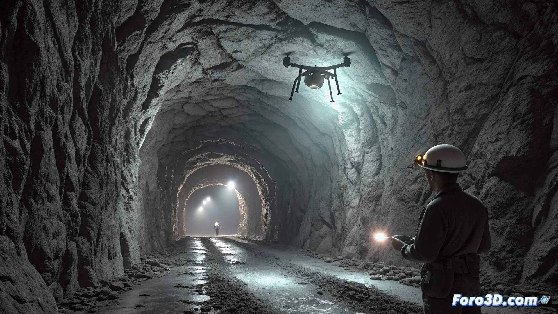
A Drone Scans a Cave to Plan the Rescue of Cavers
When a caver becomes trapped in an inaccessible passage, rescue teams face a major challenge. To assess the situation without risking more lives, they turn to a technological solution: deploying a LiDAR scanner drone into the cavity. These devices, such as the Hovermap or the Flyability ELIOS, are designed to fly in confined spaces and collect precise environmental data. 🚁
Capturing the Cave's Geometry with Millimeter Precision
The drone autonomously navigates through the tunnels, using its LiDAR sensor to record millions of points that define every surface. The mission is clear: generate a complete three-dimensional model of the cave system to find a viable route to the person. This massive point cloud contains the exact geometric information of every gallery, narrowing, and drop.
Processing Scanner Data to Generate a 3D Map:- The raw LiDAR data is transferred to a surface computer for processing.
- Specialized programs like FARO Scene or Leica Cyclone are used to align different scans and clean the point cloud.
- The final result is a precise, georeferenced 3D mesh that serves as the main working map for rescuers.
This digital model allows virtually rotating and sectioning the cave, studying every corner with millimeter accuracy before acting.
Simulating the Rescue Operation in a Virtual Environment
With the complete 3D model, the rescue team takes it a step further. They import the data into simulation environments like Blender or Unity. Here, they can not only virtually navigate the cave but also rehearse all aspects of the operation. This phase is crucial for reducing danger.
Using the 3D Model to Plan the Extraction:- They simulate if a rescuer with full gear can pass through a narrow conduit.
- They calculate the exact length of ropes, anchors, and other necessary materials.
- They identify potential risks and decide on the safest strategy, optimizing resources.
From Video Game Engines to Saving Real Lives
This methodology demonstrates how technologies associated with entertainment, such as graphics engines, have critical applications in the real world. Virtual planning allows rehearsing the entire operation, ensuring that when rescuers enter the cave, every move is calculated. Thus, technical innovation is combined with the primary goal of saving a life. 💡