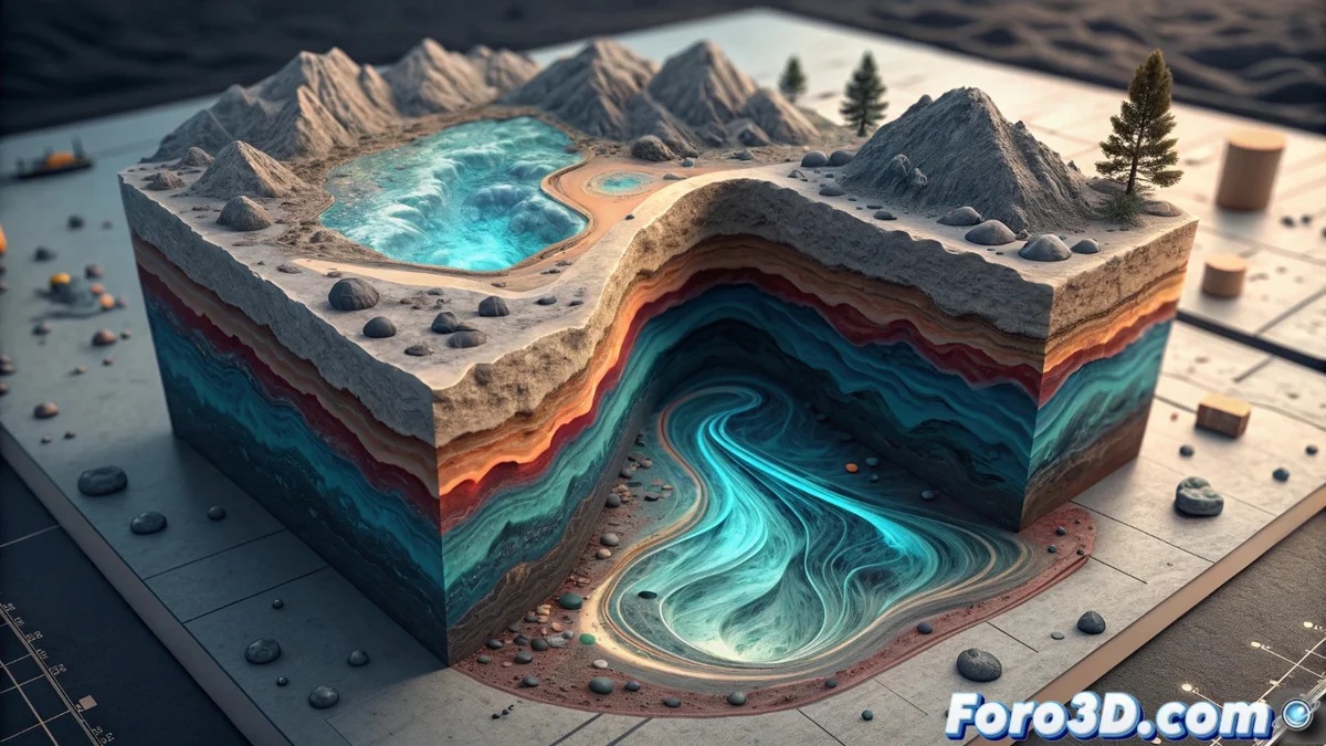
A 3D model of the subsurface tracks a contaminant in an aquifer
Discovering a harmful substance in a water well poses a puzzle: where does it come from? 🕵️♂️ To solve it, experts turn to building a digital replica of the terrain. This 3D model integrates geology information, drilling records, and well data to accurately recreate the soil layers. The purpose is to decipher how fluids move in the depths and reconstruct the path followed by the contaminant.
Digital tools to simulate the underground journey
Processing this complex information requires specific applications. Programs like Leapfrog Hydro allow agile three-dimensional geology modeling. Subsequently, hydrogeological simulation solutions, such as MODFLOW or FEFLOW, take over. These software calculate the movement of water and the contaminant along the aquifer. To achieve this, they consider key factors such as terrain porosity, natural hydraulic gradient, and the chemical characteristics of the substance involved.
Key data feeding the simulation:- Stratigraphy and properties of rock and soil layers.
- Water level and hydraulic conductivity data obtained from boreholes.
- Contaminant characteristics, such as its density and dispersion coefficient.
The subsurface holds the memory of what happens on the surface, sometimes revealing forgotten leaks that persist as a toxic legacy.
Interpreting results to find the origin
The numerical results of the simulation are taken to powerful 3D viewers, such as ParaView. In this environment, concentration maps, sectional cuts, and animated sequences are generated that illustrate the evolution of the contamination plume. By running the simulation backward in time, the most probable starting point can be inferred. This forensic methodology connects the finding in the well with a specific source, such as an industrial facility or a dumping area, guiding measures to mitigate the impact.
Fundamental graphical outputs:- Animations showing the historical spread of the contaminant.
- Isoconcentration maps in horizontal and vertical planes.
- Particle trajectory graphs that trace probable routes.
The model's precision guides action
This process not only identifies a potential culprit but also quantifies how the contamination disperses. The precision of the digital model is crucial for designing effective extraction systems or hydraulic barriers. Thus, 3D technology becomes an essential tool for protecting water resources, demonstrating that understanding the subsurface's past is key to remedying its present and securing its future. 🗺️