A 3D Forensic Pipeline for Analyzing Landslides
A three-dimensional forensic workflow allows for the digital recreation and examination of the events that cause a landslide. This system combines information from various sources, such as LiDAR scans, aerial photogrammetry with drones, satellite photographs, and geotechnical parameters. By processing and unifying these data, an exact three-dimensional recreation of the landscape before and after the incident is produced. This digital model serves as a virtual environment to verify theories about the origins of the collapse. 🏔️
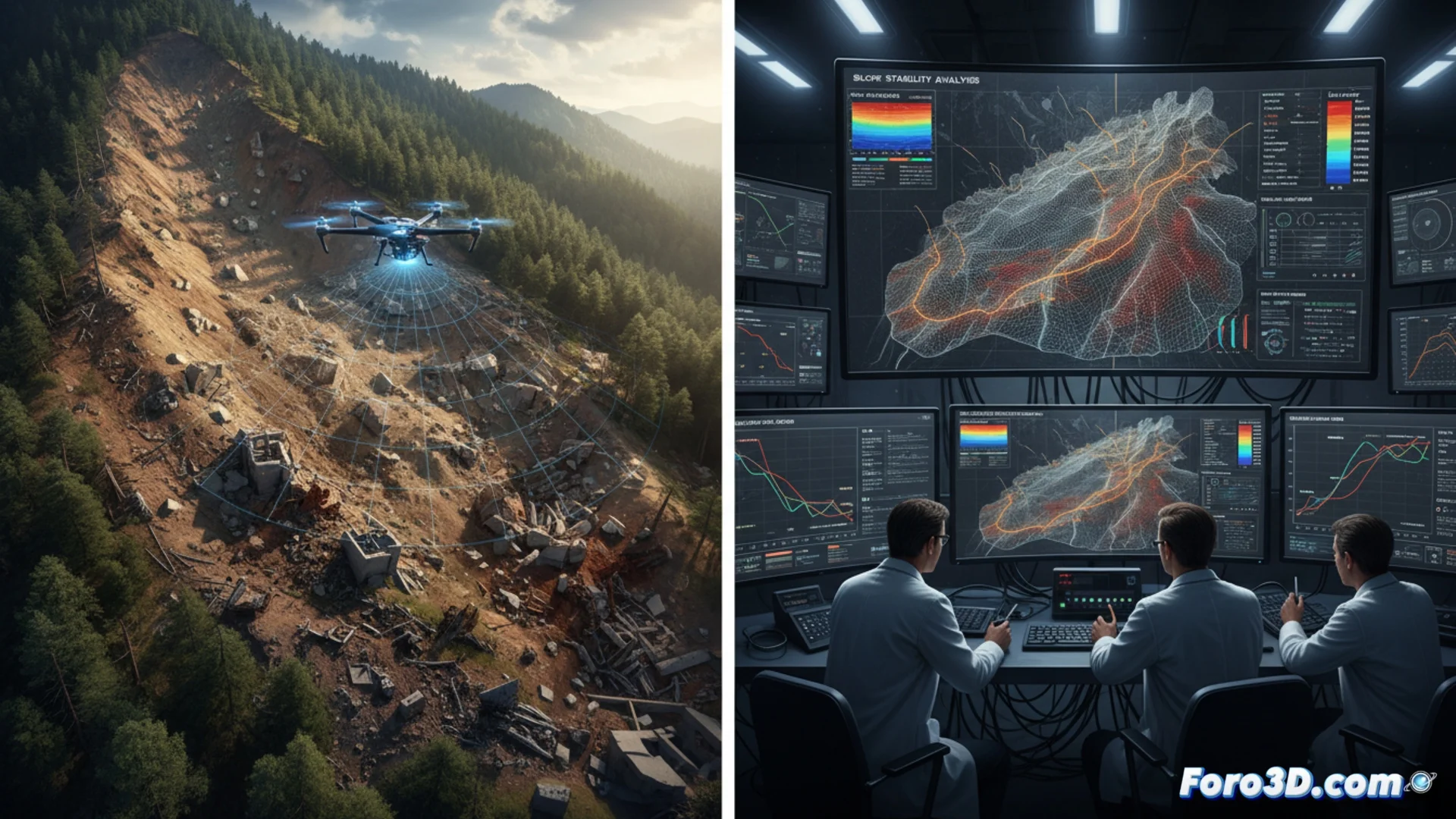
Collecting and Processing Landscape Information
The initial phase consists of obtaining data from the impacted area. Drones with LiDAR sensors and high-definition cameras are used to record the current topography in great detail. These dense point clouds are blended with archived satellite images to recreate the original state of the ground. At the same time, data on geology and terrain characteristics are collected. This entire package of information is entered into specialized software to generate polygonal meshes and digital elevation models. Accuracy is fundamental, as a flaw in the model can completely distort conclusions about the forces and soil stability.
Key Data Sources:- Drones and LiDAR: Capture the current terrain geometry with millimeter precision.
- Historical Satellite Images: Provide a reference of what the landscape was like before the event.
- Geotechnical Studies: Provide data on soil composition, strength, and moisture.
3D visualization helps understand the mechanics of the collapse and identify the factors that initiated it.
Simulating and Testing Causal Hypotheses
With the 3D model completed, advanced numerical simulations are carried out. Different boundary conditions are applied, such as variations in the water table level, seismic vibrations, or excavations at the base of the slope, to identify which one most realistically reproduces the captured landslide. Finite element analysis tools compute how the mass of earth reacts to these stimuli. The simulation results are compared with the real physical evidence found at the site: soil fractures, debris trajectory, and affected surface. This repetitive cycle helps isolate the combination of elements that most likely triggered the event, generating solid technical evidence.
Commonly Simulated Factors:- Water Saturation: Effect of intense rains on slope stability.
- Seismic Activity: How seismic waves can destabilize the terrain.
- Human Intervention: Impact of cuts at the base or overloads at the top.
The Value of the Final Representation
This forensic process culminates in visual representations that go beyond the technical. Sometimes, the most crucial render is not the most complex, but the one that clearly points out the risk zone where, for example, construction should not have taken place. The ability to intuitively and objectively show the cause-effect relationship makes this pipeline an indispensable tool for engineers, geologists, and legal experts. The 3D digital reconstruction thus becomes a fundamental proof for understanding and preventing future natural disasters. ⚖️