For decades, residents of Taos, New Mexico, and other global locations, have reported an annoying low-frequency hum of unknown origin. This phenomenon, known as The Hum, represents a scientific enigma at the intersection of acoustics, geophysics, and sensory perception. In the niche of scientific visualization, this mystery becomes the perfect opportunity to apply advanced 3D representation techniques. The goal is to transform scattered and subjective data into interactive models that allow for the analysis of hypotheses and communicate the complexity of the case in an intuitive and rigorous manner.
3D Modeling Strategies for an Elusive Phenomenon 🔊
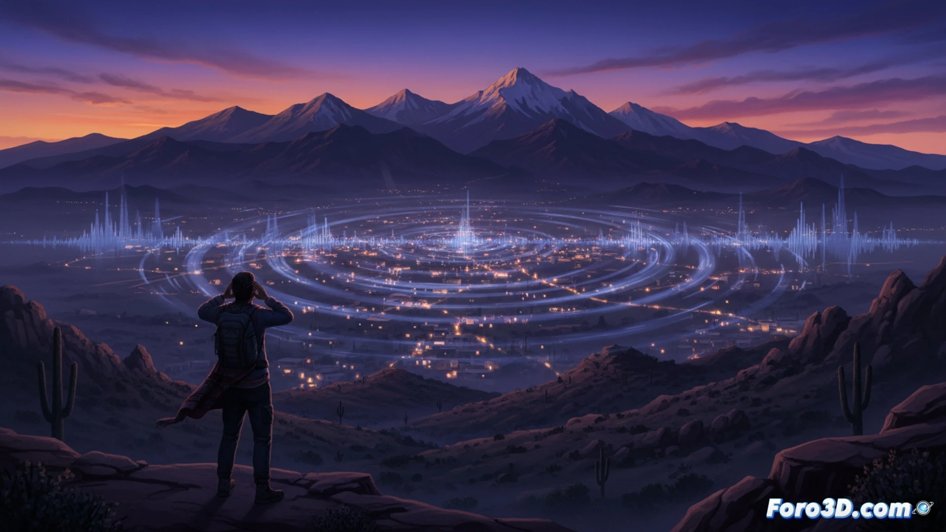
The scientific visualization of the Taos Hum requires integrating multiple layers of information into a unified 3D environment. A key strategy is the creation of an interactive geospatial map that places witness reports, coded by perceived intensity and frequency, onto a topographic and geological model of the area. On top of this, 3D volumes could be superimposed to represent the hypothetical propagation of acoustic waves from candidate sources, such as geological faults or distant industrial activity, considering atmospheric attenuation. In parallel, a real-time spectral analysis model, visualized as a 3D spectrogram, would allow for contrasting instrumental measurements with subjective descriptions. This multivariate approach can reveal hidden patterns and rule out origins by demonstrating spatial or physical incompatibilities in the model.
Beyond the Map: Visualization as a Research Tool 🧪
The true power of this 3D model lies not only in illustrating the mystery but in acting as a virtual testing ground. Researchers could simulate scenarios, introducing variables such as new noise sources or changes in atmospheric conditions, to observe their impact on the reported hum pattern. This capability transforms visualization from a communication tool into an active research instrument. By making the intangible tangible, it fosters more effective interdisciplinary collaboration and brings the public closer to the scientific methodology, showing how knowledge is built and tested in the face of an unsolved enigma.
How can we use 3D scientific visualization techniques to analyze and represent acoustic and geophysical data in order to model and explore the possible sources of the mysterious Taos Hum?
(PS: modeling manta rays is easy, the hard part is making them not look like floating plastic bags)