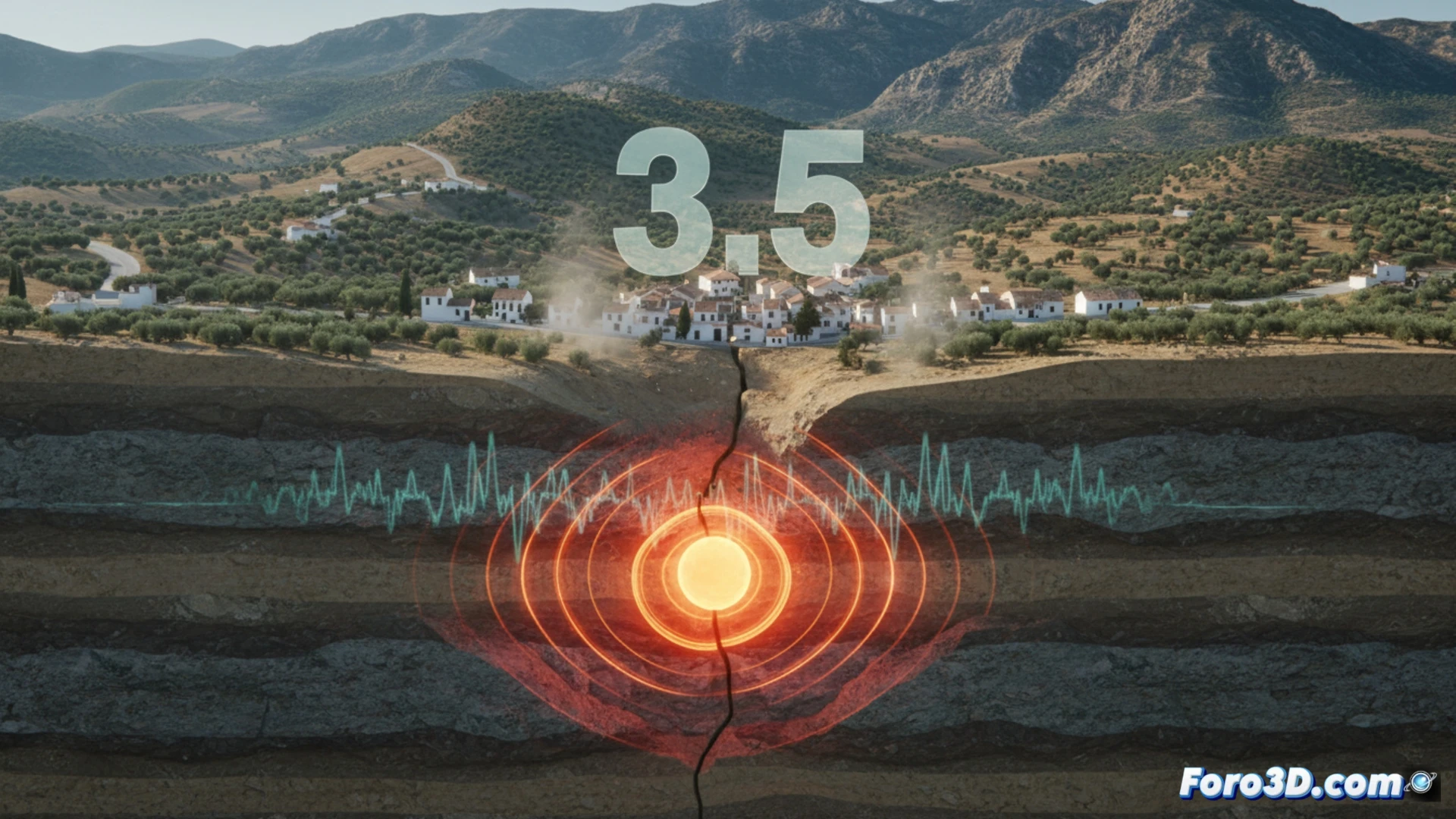
Last Tuesday, a magnitude 3.5 earthquake shook the town of Jayena in Granada, according to the National Geographic Institute. The quake, recorded at 12:45 p.m., had its epicenter at a depth of 10 kilometers and was felt in nearby municipalities such as Alhama de Granada. Although no material or personal damage was reported, the tremor caused concern among residents, who described a brief but intense vibration. Civil Protection activated monitoring protocols without serious incidents.
3D modeling of the epicenter and propagation of seismic waves 🌍
To recreate this event in 3D, the first step is to model the hypocenter at 10 km depth beneath the Granada Basin, an area of high tectonic activity due to the local fault. Using geological simulation software, we can generate a seismic intensity map showing how P and S waves propagated radially from the epicenter. The animation should reflect the attenuation of energy on the surface, explaining why the movement was brief but noticeable in Jayena and Alhama. Including ground acceleration data (PGA) helps visualize the tremor distribution, highlighting that the focal depth reduced the risk of structural damage.
Tectonic lessons for visual prevention 🧠
This earthquake, although mild, reminds us of the importance of understanding the dynamics of the Granada Basin fault. Recreating earthquakes in 3D not only allows us to analyze their behavior but also to educate the population about local seismic response. The simulation of the ground motion, combined with intensity maps, helps identify areas of greater vulnerability and design more effective emergency protocols. At Foro3D, we believe that visualizing these phenomena is key to turning concern into practical knowledge.
What variables would you consider to model this disaster? 🤔