A conflict between neighboring farms has escalated into an environmental forensic case. An organic farmer lost his entire harvest after the spraying of an adjacent field. The accusation of chemical drift was clear, but the neighboring farmer's defense argued that the vegetative barrier was sufficient. However, traditional 2D topography did not reveal the truth. Only a deep three-dimensional analysis could uncover the critical flaw in the natural defense.
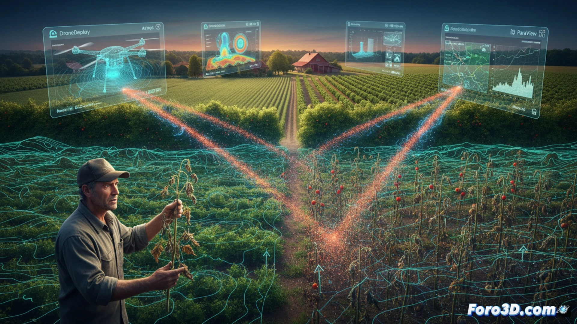
Forensic reconstruction with DroneDeploy, ArcGIS Pro, and Ansys Fluent 🛰️
The technical team used a drone to capture the terrain via DroneDeploy, creating a high-resolution point cloud. This model was integrated into ArcGIS Pro to precisely georeference the sprinklers and tree species of the barrier. The turning point came when exporting this model to Ansys Fluent. The particle simulation, with real wind conditions from the day of the incident, demonstrated that the airflow was channeled through a small gap in the vegetation. This void, invisible on a 2D plan, acted as a dispersion cannon, carrying the pesticide directly to the organic crop 50 meters away.
The value of 3D modeling in environmental justice ⚖️
This case demonstrates that simple visual inspection or two-dimensional plans are no longer sufficient to determine liability in pollution disasters. The 3D particle simulation not only identified the gap in the barrier but also quantified the chemical concentration at the impact point. Tools like ParaView allowed visualizing the lethal trajectory, turning a suspicion into irrefutable proof. For industry professionals, this technique is consolidating as the gold standard in the expert assessment of agricultural and environmental catastrophes.
How can a 3D particle simulation differentiate between deliberate chemical sabotage and an agricultural disaster caused by accidental pesticide drift in a conflict between neighboring farms.
(PS: Simulating catastrophes is fun until your computer melts down and you are the catastrophe.)