The tragic incident that occurred early this morning on the A-7 motorway near Orihuela, where a pedestrian lost their life after being struck by a vehicle, presents a complex scenario for investigators. The victim was on the roadway around 3:30 AM, and the reasons for their presence at that critical point are still unknown. The Guardia Civil faces the challenge of reconstructing the moments prior to the impact under conditions of low nighttime visibility.
3D documentation of the impact scene 🚗
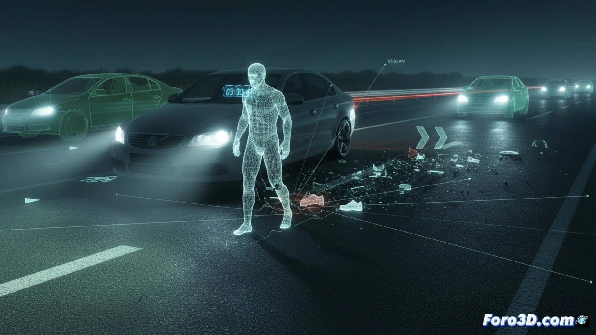
The application of three-dimensional documentation techniques, such as digital photogrammetry and laser scanning, allows forensic teams to capture the geometry of the site with millimeter precision. In the case of the A-7, the pedestrian's final position, skid marks, debris on the roadway, and the deformation of the involved vehicle can be modeled. With this data, a georeferenced 3D model is generated, enabling the calculation of trajectories, relative speeds, and impact points. Additionally, analysis of ambient lighting and road geometry helps determine the actual visibility of both the driver and the pedestrian at the exact moment of the collision.
Forensic simulations to clarify the incident 🔍
Virtual reconstruction not only documents the scene but also allows for kinematic simulations to test hypotheses. Experts can assess whether the pedestrian was crossing, standing still, or fell onto the roadway, as well as analyze the driver's reaction to a sudden obstacle. These reports, supported by certified 3D models, are presented in court as visual and quantitative evidence, facilitating the determination of liability and ruling out causes such as mechanical failure or avoidable distraction.
Would you combine scanning with photogrammetry? 💡