The collapse of a mining tailings dam triggered an environmental and human catastrophe that demanded precise answers. Initial reports pointed to structural failures, but forensic analysis using 3D technologies changed the diagnosis. The combination of LiDAR data, geological models in Leapfrog Geo, and simulations in GeoStudio allowed researchers to isolate the final trigger: the vibrations of heavy machinery operating near the dam crest. This case demonstrates how digital geotechnics can turn a disaster into a lesson in prevention.
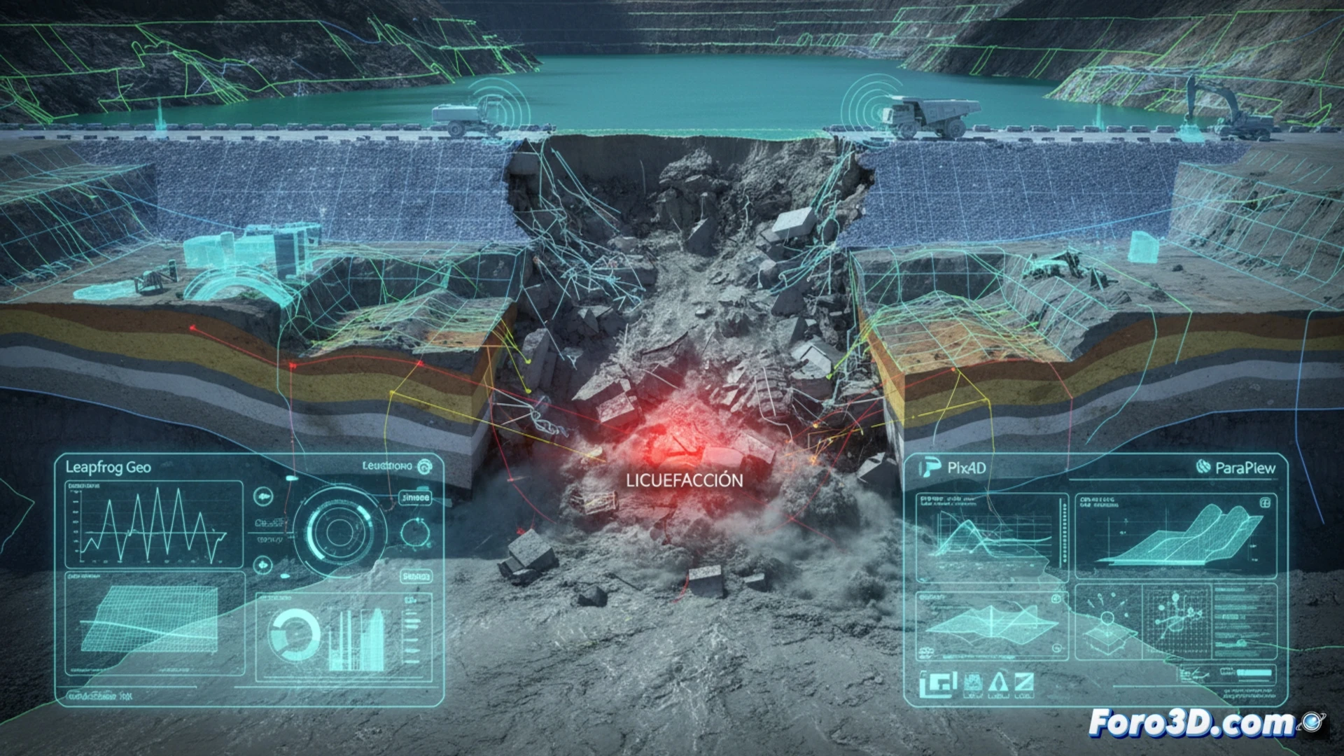
Forensic workflow: from LiDAR scanning to liquefaction simulation 🔍
The process began with a LiDAR flight over the collapsed tailings dam, generating a high-density point cloud that captured the post-failure topography and fracture patterns. This data was imported into Leapfrog Geo to reconstruct the 3D geological model of the subsurface, identifying layers of saturated sludge and weak zones. With that model, a simulation in GeoStudio was calibrated, incorporating cyclic loads. The results showed that vibrations from trucks and excavators, within a specific frequency range, generated an increase in pore pressure within the sludge, leading the material to a state of liquefaction and total loss of strength. The final visualization in ParaView allowed experts to present an animated sequence of the collapse, impossible to refute.
Prevention and responsibility: the value of the digital twin 🛡️
Beyond determining responsibilities, this case underscores the value of digital twins in modern mining. If the operation had had a similar predictive model, the machinery vibrations would have been detected as a critical risk. Today, technology allows simulating soil fatigue scenarios before a disaster occurs. Liquefaction is not a random event; it is a physical process that can be anticipated with the right tools. The tragedy thus becomes a catalyst for implementing continuous monitoring through sensors and 4D modeling, where time is the fourth dimension that saves lives.
Is it possible that the phenomenon of liquefaction in a mining tailings dam can be predicted in real-time by combining data from LiDAR scanners with high-resolution digital elevation models, or does the catastrophe always occur suddenly and unpredictably?
(PS: Simulating catastrophes is fun until the computer crashes and you are the catastrophe.)