The disappearance of a 28-year-old young mother on August 9, 2025, and the discovery of her charred remains in October in the Creu mountain present an extreme forensic challenge. The body was located by a hiker in an area previously affected by a forest fire, complicating the dating of death and the chain of custody of the scene. The application of 3D technologies becomes the only tool capable of extracting reliable data from a devastated environment.
Virtual reconstruction and trajectory analysis 🕵️
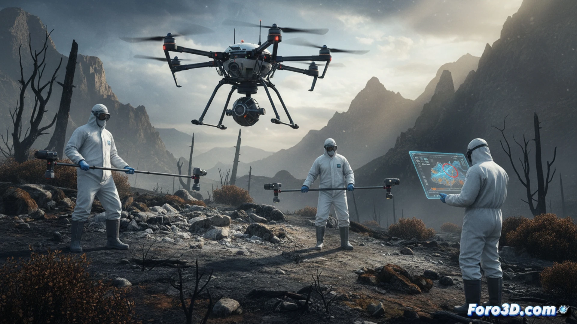
The forensic protocol in this case begins with a drone flight equipped with a LiDAR sensor and high-resolution camera to capture the mountain's topography. Through photogrammetry, a georeferenced 3D model is generated that includes the exact position of the charred corpse and the distribution of the fire's ashes. This model allows investigators to simulate the fire's spread and determine whether the body was placed before or after the incident. Additionally, scanning the drag marks on the ground facilitates the reconstruction of the victim's and possible aggressor's trajectory, even under the layer of soot.
The scene as a silent witness 🔥
A charred corpse loses almost all superficial biological evidence, but its surroundings preserve the geometry of the crime. The 3D model of the Creu mountain acts as an immutable witness that investigators can interrogate months later. The ability to perform virtual measurements, recreate the lighting of the early morning of August 9, and overlay layers of temporal data turns the scene into a perpetual digital archive. In cases like this, where fire erases the traces, 3D technology writes the final word.
How can forensic photogrammetry be integrated with climate and fire data analysis to reconstruct the sequence of events that led to the disappearance and subsequent charring of the body in a mountainous environment like the Creu mountain?
(PS: don't forget to calibrate the laser scanner before documenting the scene... or you might be modeling a ghost)