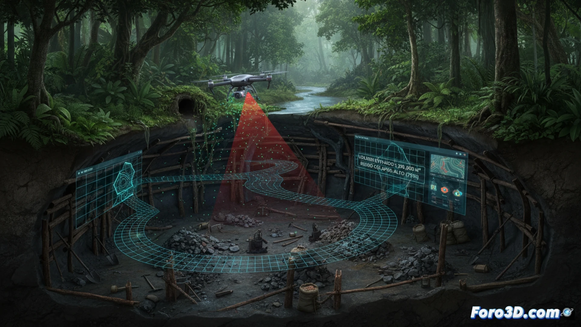
Illegal mining in protected areas leaves a trail of destruction that is difficult to quantify, until now. An autonomous Hovermap drone, equipped with a LiDAR scanner, ventures into tunnels with no lighting or GPS signal. The result is a three-dimensional point cloud that allows experts to accurately calculate the volume of extracted earth, assess the risk of surface collapse, and present irrefutable evidence of environmental damage.
Technical workflow: from autonomous scanning to volumetric model 🛠️
The process begins with the Hovermap drone operating in SLAM mode, allowing it to map tunnels without relying on GPS. It captures millions of points per second, generating a georeferenced point cloud of the cavity. This cloud is imported into CloudCompare, where a noise filter is applied and a virtual reference plane of the original terrain is defined. The 2.5D Volume Calculation tool estimates the exact volume of the void. Finally, the coordinates are exported to QGIS to geolocate the gallery on the cadastral map of the protected area. The millimeter precision of this method far surpasses traditional visual estimates.
Beyond the data: the point cloud as expert evidence ⚖️
The value of this workflow is not only technical but also legal. A 3D model created in Blender allows judges and prosecutors to take a virtual tour inside the illegal mine, understanding the magnitude of the crime. The combination of extracted volume, geotechnical risk, and geolocation turns LiDAR scanning into a key forensic tool for quantifying environmental damage and assigning responsibilities.
How can the exact volume of an illegal underground excavation be calculated using LiDAR data from a Hovermap drone, considering dense vegetation and the lack of direct site access?
(PS: 3D topography is like making a treasure map, but the treasure is an accurate model.)