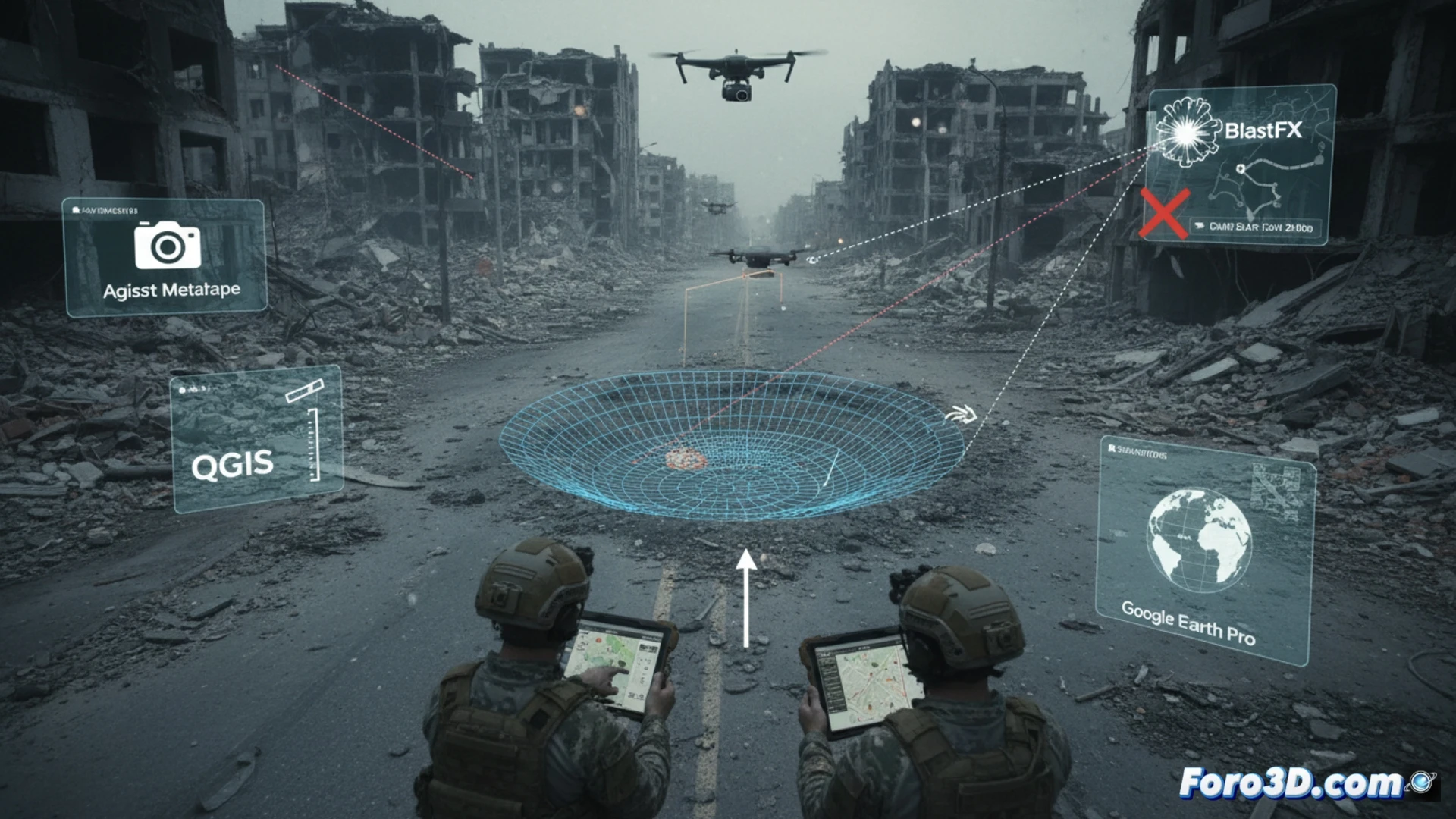
Forensic craterology has taken a quantitative leap with the integration of aerial photogrammetry. In urban artillery scenarios, each crater is a ballistic signature. A drone captures dozens of oblique and zenithal images of the impact. Agisoft Metashape processes the dataset to generate a dense point cloud and a high-resolution textured mesh model. This digital twin of the crater is the basis of the analysis.
Forensic workflow: from point cloud to trajectory 🚀
The 3D model is exported to QGIS for precise georeferencing and measurement of critical parameters. Crater asymmetry and the distribution of debris ejection (greater accumulation in the impact direction) are key data. With BlastFX, the explosion dynamics are simulated and the trajectory vector is calculated. This vector is projected in Google Earth Pro, intersecting with lines of sight and terrain elevations to geolocate the source battery. The sub-centimeter precision of the model allows determining the caliber and type of ammunition.
Implications for verification and documentation of war crimes ⚖️
This workflow transforms a crater into judicial evidence. The methodology allows contrasting official statements with physical data, identifying false positives or indiscriminate attacks. Each 3D model serves as expert evidence, documenting the direction of fire and corroborating violations of International Humanitarian Law. The combination of open-source software and commercial drones democratizes on-the-ground investigation capabilities.
Is it possible to determine the exact caliber of an artillery projectile by analyzing the three-dimensional morphology of a crater generated by drone photogrammetry in Metashape?
(PS: at Foro3D we document war damage with the same precision as our meshes: millimeter-level)