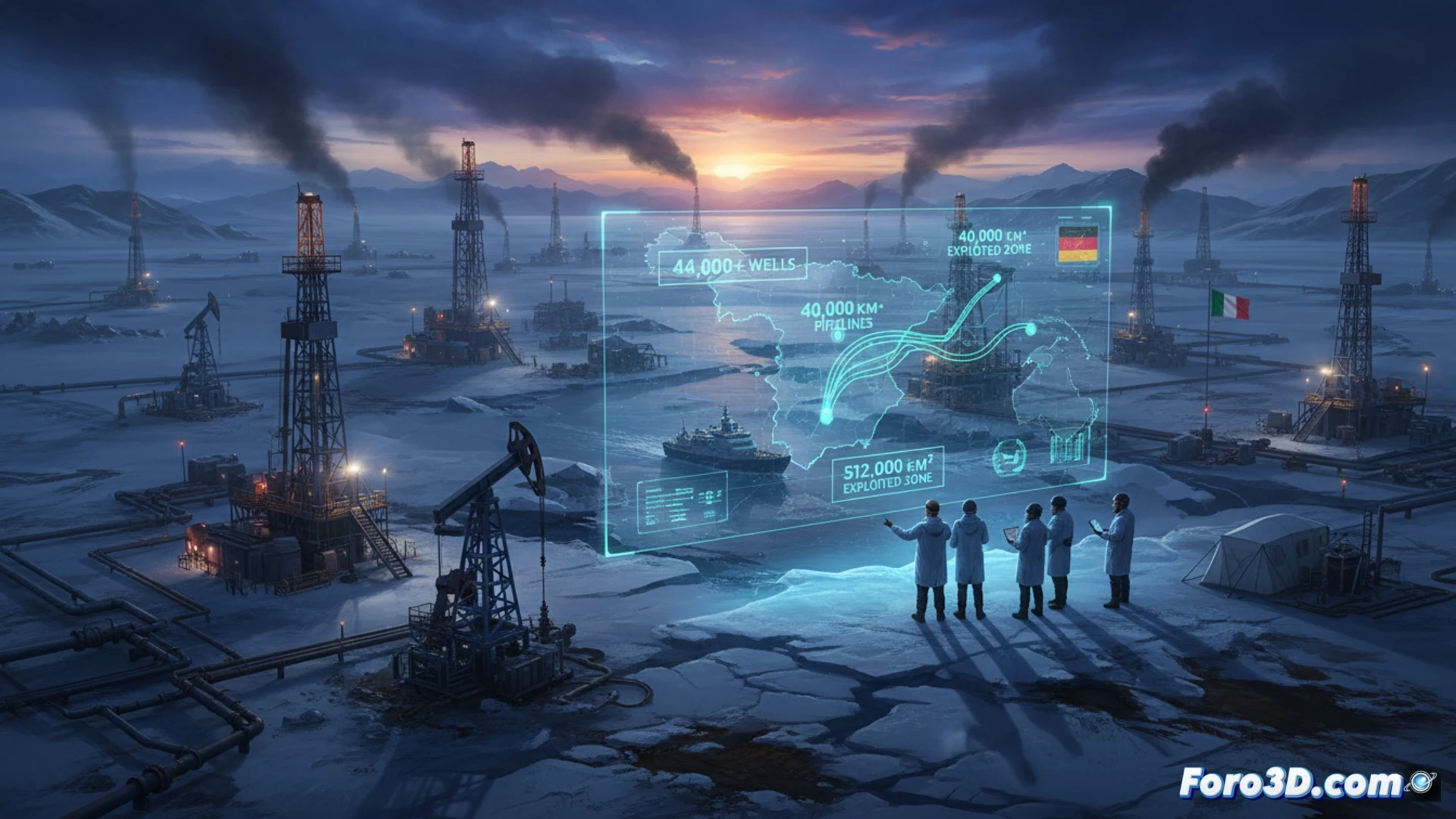
An Italian-German team led by Daniele Codato has published in Plos One the first detailed atlas of oil and gas exploitation in the Arctic. The study maps 512,000 square kilometers of territory already in use, an area similar to Spain, with more than 44,000 active wells and 40,000 kilometers of pipelines crossing the ice.
Satellite data to map the white gold rush 🛰️
The team used high-resolution satellite images and energy infrastructure data to create a comprehensive map of the region. The research not only locates the wells and pipelines but also quantifies the cumulative impact on a fragile ecosystem. Codato points out that the analysis allows visualizing the expansion of the industry in previously pristine areas, offering an open database for future studies on climate change and Arctic geopolitics.
The Arctic, that new residential neighborhood with views of the melting ice 🏠
With 44,000 wells, the Arctic seems more urbanized than many cities. If we put all those holes together, we could have the largest golf course in the world, though with less green and more crude. Of course, the view from the green is spectacular: icebergs melting at sunset. The oil industry has already reserved its plot; all that's left is to put curtains on the pipelines.