The recent announcement of a joint attack on Eilat, led by Houthis, Iran and Hezbollah, transcends the news text. To understand its technical dimension, we begin a 3D reconstruction of the scenario. We will model the city's unique geography, also called Umm al Rashrash, and simulate the hypothetical trajectories of the described cruise missiles and drones, analyzing their potential impact on critical infrastructure from a visual perspective.
Technical reconstruction: geospatial modeling and trajectory simulation 🗺️
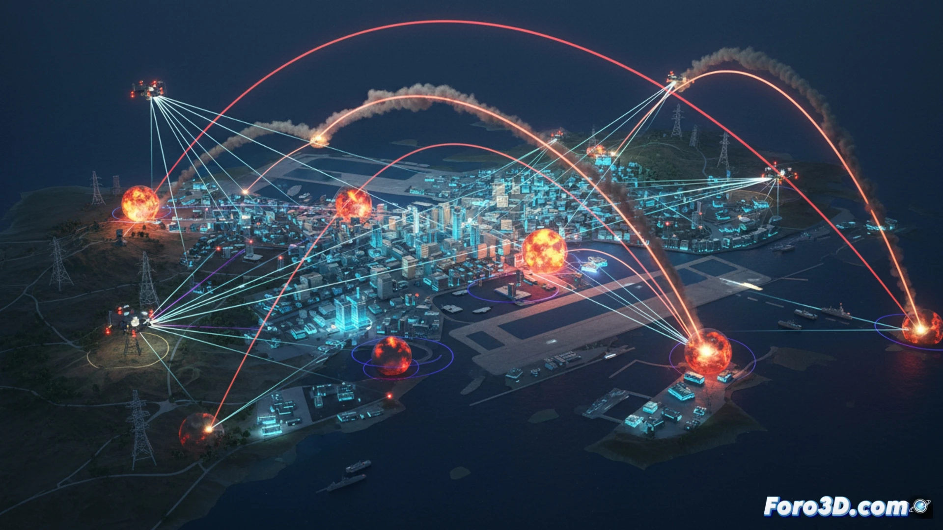
The first step is a geo-referenced 3D model of Eilat and its surroundings, incorporating topography and the layout of potential targets. On this environment, the attack trajectories are simulated. Cruise missiles, with a low and terrain-following profile, would require flight modeling that avoids terrain. Drones, slower and with a possible reconnaissance pattern, are visualized on alternative routes. The overlay of both vectors in the simulation reveals convergence points and the logistical complexity of a coordinated attack from multiple origins.
Beyond the impact: visualizing the evolution of asymmetric threats 🎯
This 3D visualization exercise does not only seek to illustrate an event. Its educational value lies in making tangible the nature of contemporary threats: the remote coordination between non-state actors, the use of accessible technology, and the exploitation of vast geographies. By seeing the reconstructed scenario, one better understands the scale of the defensive challenge and how the mastery of information and simulation is already an essential battlefield.
How can the trajectory and impact point of the missiles and drones in the attack on Eilat be reconstructed in 3D to determine the technical capabilities and coordination between the different actors involved?
(PS: modeling destroyed buildings is easy, the hard part is making sure the software doesn't crash before they do)